Wednesday, September 09, 2009

In Search of the Northwest Passage


I've been trying to find a good bike shortcut to Takoma Park and Silver Spring. Driving, we have a more-or-less straight shot up East-West Highway, but that isn't suitable for driving. And once I get close, the Sligo Creek Trail and various on-road bike routes make things easy. But it's tricky handling the distance between home and where the East-West Highway hits Sligo Creek Trail.

Fortunately, I collect lots of data about my rides, so I can make both an objective and a subjective comparison.

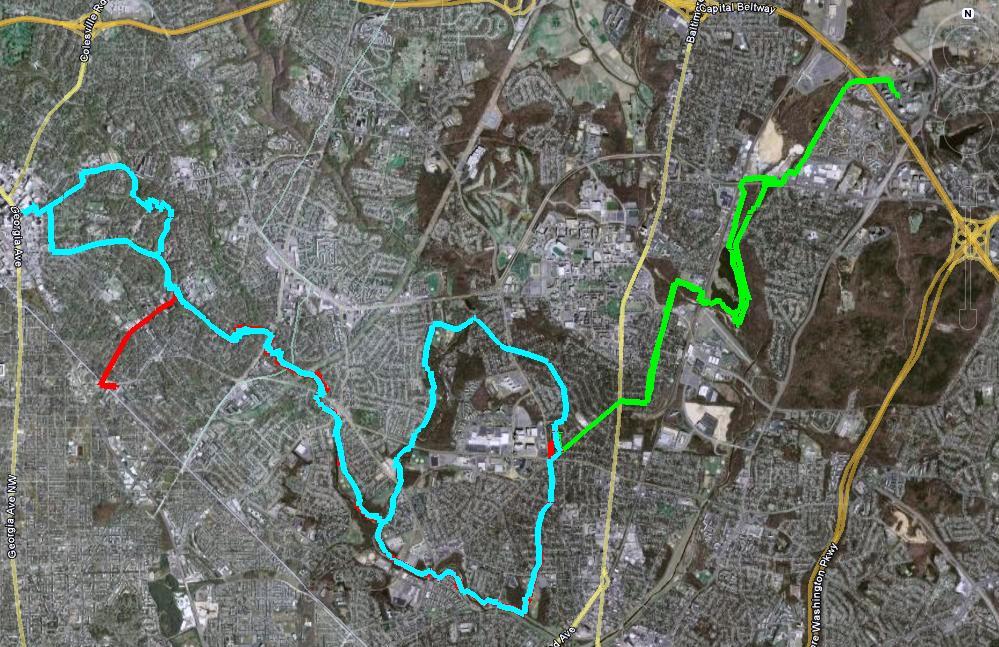
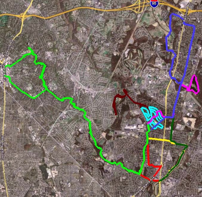
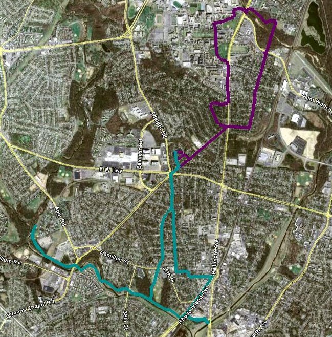
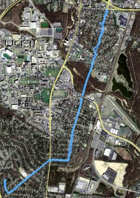
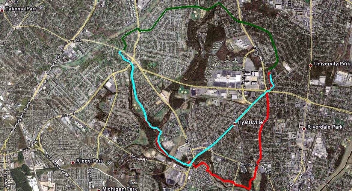
My first attempts (red path) were done by going south through Hyattsville and Magruder Park and taking the Northwest Branch Trail to the Sligo Creek Trail. It's somewhat roundabout, but it's all easy biking on either residential streets or a scenic set of trails. Time: 31 minutes. Distance: 4.6 miles.

From the first time I looked at the map, I had my eye on a route via residential streets to the west of home (green path). Christina and I explored the route via Wells Parkway and Wells Boulevard to a park we call "Stolen Mulch Park". (The first time we drove by, we saw some women helping themselves to some mulch that had been clearly placed for park use.) One day I decided to push through along the route marked on my bike map. Unfortunately, this route involves crossing Riggs Road, but not at a crosswalk. Riggs Road is fairly busy and doesn't feature many lights or crosswalks. It does have a median, so I did eventually get across, but it was not fun. The only thing this route has to recommend it is that it is the shortest-distance one I tried. Time: 25 minutes. Distance: 2.9 miles.

When I looked at the map again, I saw Queens Chapel Road marked as a bike route (blue path). I had been fairly skeptical, because I know Queens Chapel is fairly busy outside of University Park. When I rode down it, however, I realized it has a nice, wide shoulder. Except for a small segment where people park cars on weekends, it's fairly easy to avoid most traffic before picking up the Northwest Branch Trail. It's a bit hillier than other routes, and not as scenic as going via Magruder Park, but it's the fastest route, and it doesn't involve any scary intersections. If I'm trying to make it farther into Montgomery County, I'll definitely take this path; if I'm looking for a more leisurely ride, I'll probably go via Magruder Park. Time: 22 minutes. Distance: 3.6 miles.

This analysis may seem like overkill for differences of at most 9 minutes or 1.7 miles. But those differences are doubled for a round trip and definitely make a difference between a reasonable ride and one that leaves me feeling wiped out. So, until the county wises up and builds a better path, I think I have the information I need.

Posted by Picasa

Tuesday, September 08, 2009

Google Books, genealogy and the Metcalfs

I was reading an article about Google scanning books and putting them on-line, and I decided to see if I could use some of these books to help me with genealogy research. I found out that one of the books scanned was "Metcalf Genealogy", published in 1898. As it turns out, my great-great-great aunt married a Metcalf...

This snippet was of some interest:

Ann Elisabeth Howes, born March 31, 1847; lived,
after her parents' death, with Clark Eldred, Elyria;
taught school many years in Lorain County, O., and Grant
Co., Wis.; married, October, 1879, to Alexander Cairns,
of Bloomington and Mt. Hope, Wis. One son, Earl
Cairns, born Aug. 9, 1880.


(Earl Cairns was my great-grandfather.)

My great-great grandmother Ann Elizabeth Howes was born in Northampton, England. Her parents, William and Elizabeth Howes, came to Ohio from England some time between 1850 (when their 5th child was born) and 1852 (when their 6th child was born). Not long after that, they got sick and died. Their children were adopted out to six different families in Elyria, Ohio. Ann's two oldest brothers fought in the Civil War; both died, although one of them, a doctor, survived with his wounds until 1874. Two other siblings married their adoptive siblings (ewww). (The remaining sister was the one who married a Metcalf.)
Of Ann's parents, the book says this:

William Elliot Howes, born March 22, 1818; married
Elisabeth West, who was born Sept. 27, 1817, at Gaton-
wood House, Northampton, Eng., where the family had
lived for three hundred years. Elisabeth West's father,
Thomas West, was born March 23, 1785; died Jan. 3,
1828. His wife, Ann Fairbrother West, was born June
18, 1785. After her husband's death she managed the
great Gatonwood Farm herself for nearly forty years, dy-
ing Jan. 29, 1866.


Gaytonwood Farm appears to be a campground now; here is a picture.

This book contains a lot more information about this branch of the family than had before. I have now added a lot of information about Ann Elizabeth Howes and her family to my database. Learning from past mistakes, I have footnoted it carefully with the source. Google Books gets a thumbs-up for its treatment of out-of-copyright books. (I am taking no position on their handling of in-copyright works.)

Wednesday, September 02, 2009

Grantham's Problem

(Cross-posted from my math blog, which I'm pretty sure nobody reads.)

While reviewing the referee's 44 (sigh) suggested changes to my paper, I came across an article published last November entitled "Inefficacious Conditions of the Frobenius Primality Test and Grantham's Problem".

I have a problem named after me!

So the next time someone asks me, "What's your problem?" I can say, "Are there any composite numbers n ≡ ±2 (mod 5) such that x^(n+1) ≡ 5 (mod(n, x^2 + 5x + 5))?"

Sunday, August 30, 2009

Biking Santa Barbara


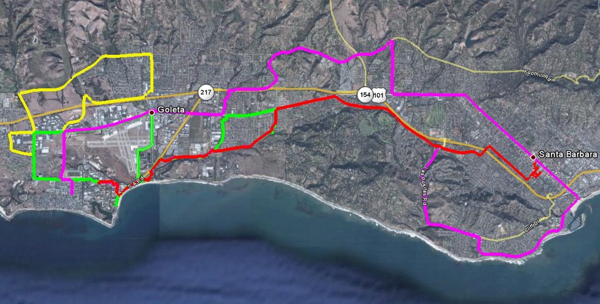
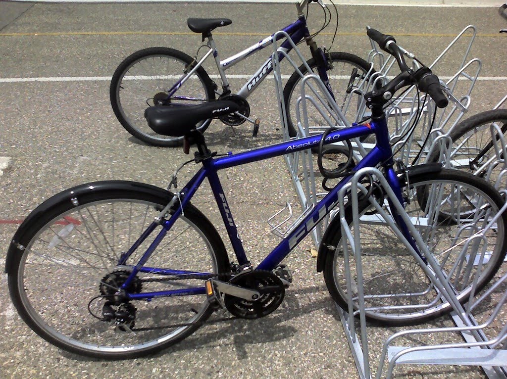
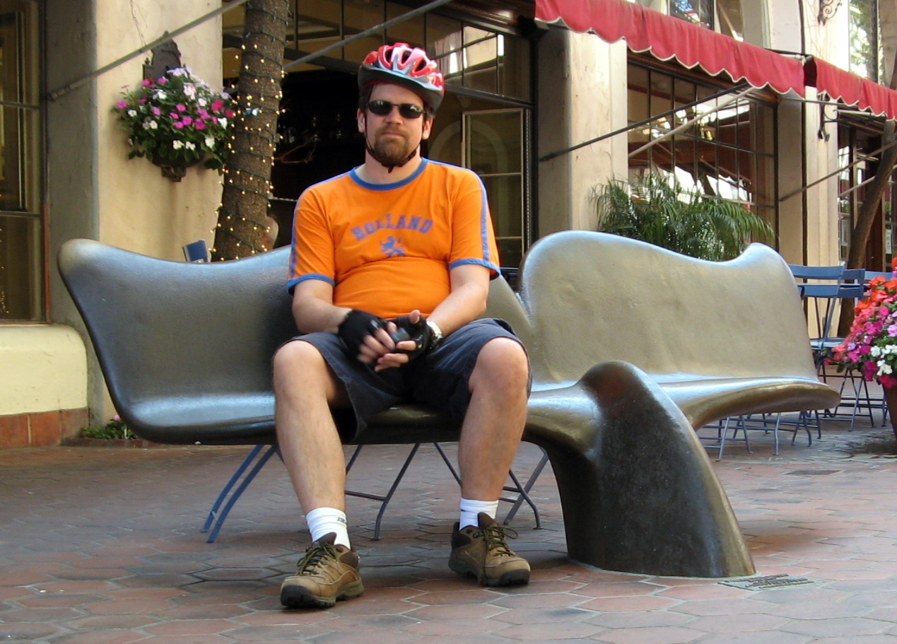
I rented a bike when I was in Santa Barbara for a conference earlier this month. I got in over 80 miles of biking in 4 days, so it was more than I'm used to doing. One day I did 27.9 miles, a personal best (and an exhausting one). The weather was cool, the terrain was flat, and the bike paths were well marked -- all conducive to lots of riding. Two of the days I just rode around near campus on breaks from the conference. Two of the days, on the other hand, I had free afternoons and challenged myself to ride from campus to downtown Santa Barbara.

Both times I did some waymarking...I made it up to 250 categories (from 202 in February). I thought the bike would be great for waymarking, but there were so many waymarks close together, the bike was a nuisance. (Or the waymarks were.)


Posted by Picasa

Tuesday, August 04, 2009

Halfway to Mexico (and Back)

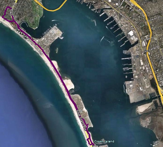
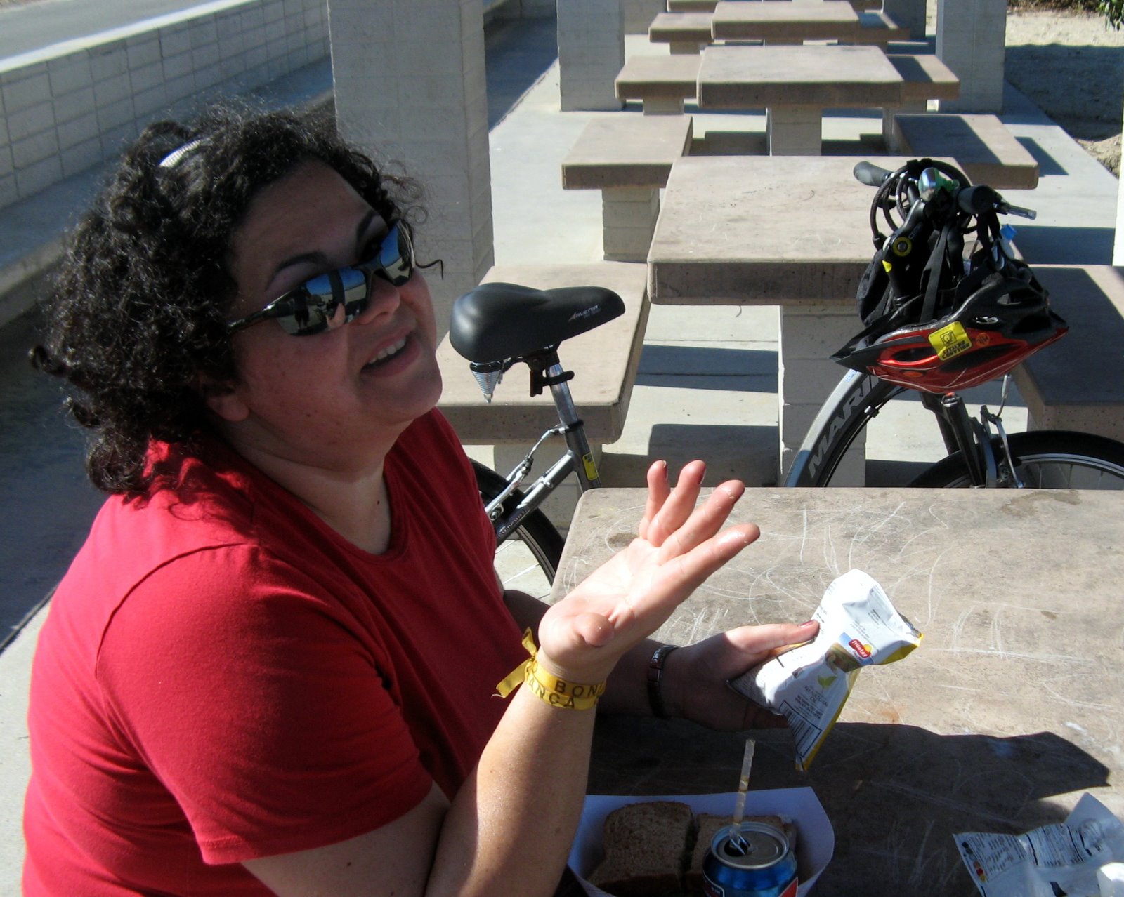
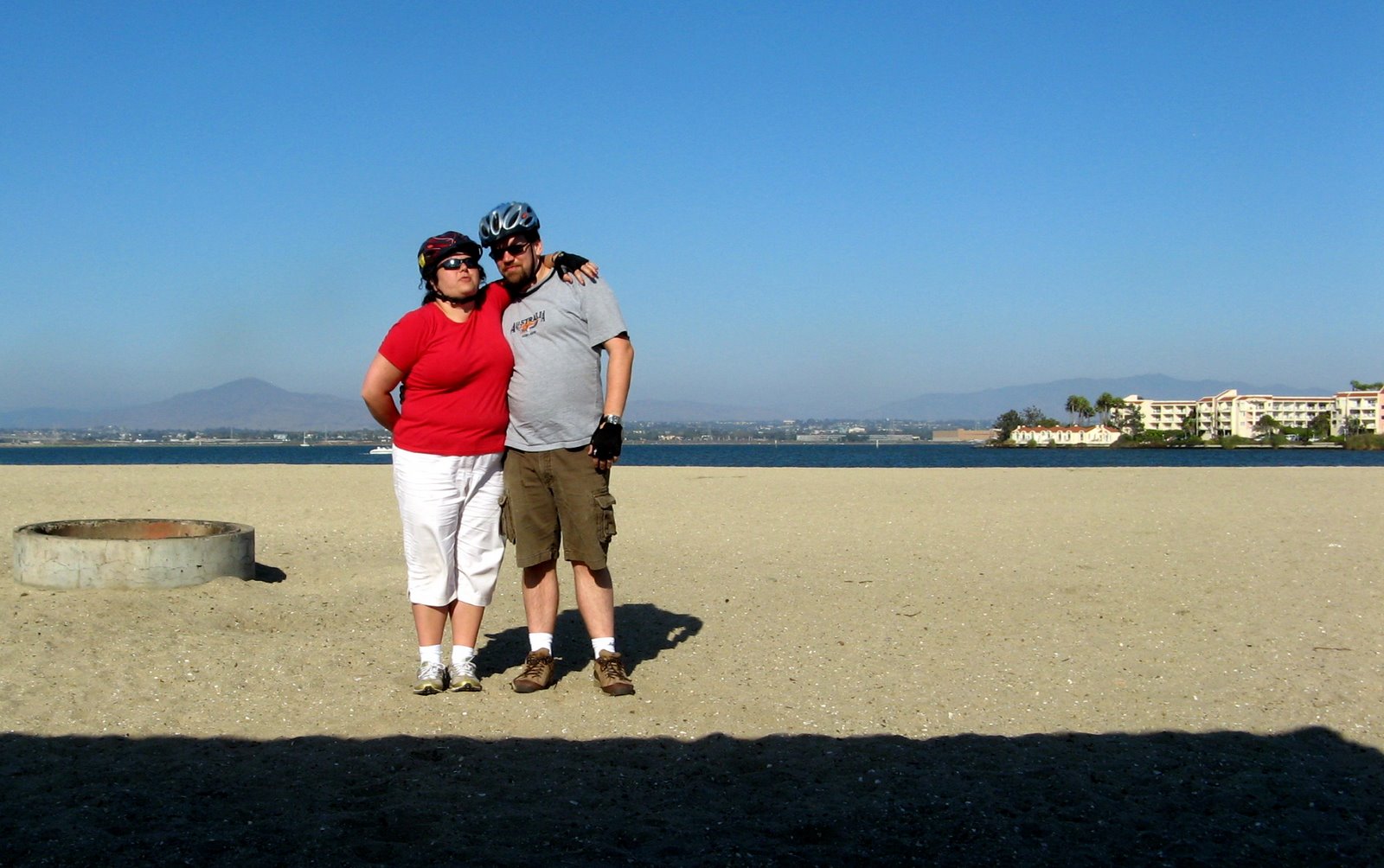
For Christina's birthday, we drove the bikes down to Coronado and rode down to Silver Strand State Beach. When I looked at the satellite view of the trip, I realized that the ride had covered about half the distance from Coronado to Mexico (hence the title of the post).

The ride is really beautiful, with San Diego Bay on one side and the Pacific Ocean on the other. The beach is also very nice -- it's actually two beaches, one on each side.

All in all, a fun excursion, and a fitting way to celebrate Christina's birthday, since she got us on the biking kick starting with our trip to Holland almost a year ago.


Posted by Picasa

Thursday, July 23, 2009

Bike To Work

 
Posted by Picasa


On Monday, we drove down to Coronado and rented bikes. On Tuesday, I biked to work, following the above path. It's a lot easier in California, what with the bike lanes and such. I also biked to work on substantially the same path the following two days -- I'm not going to record any more trips to work unless I take a different way. I have one idea for that, but the path depicted above has been easy enough -- about 3.5 miles each way, no incredibly awful stretches of uphill biking.

Saturday, July 18, 2009

3 recent bike trips

I've had three more bike rides in the past week.


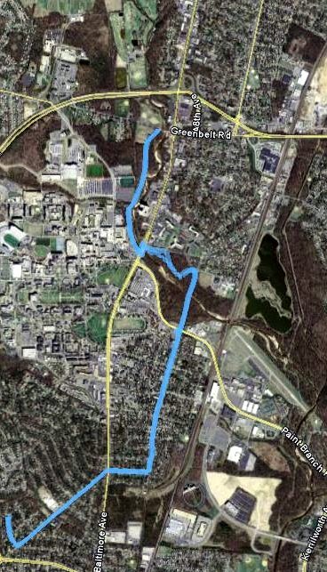
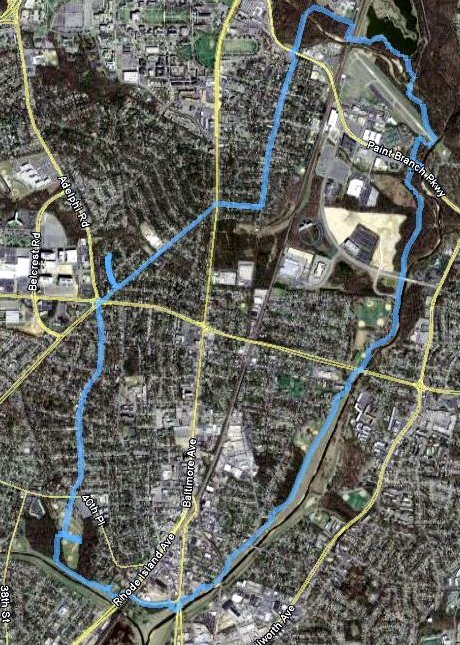
Last weekend, I took another trip to Silver Spring (light blue path). On the way there, I tried a partial shortcut. While the full shortcut will undoubtedly save 1.5-2 miles, the partial shortcut was longer. On the way back, I went the "long" way and didn't get lost, and it was only 8.4 miles. The full shortcut should bring this under 7.

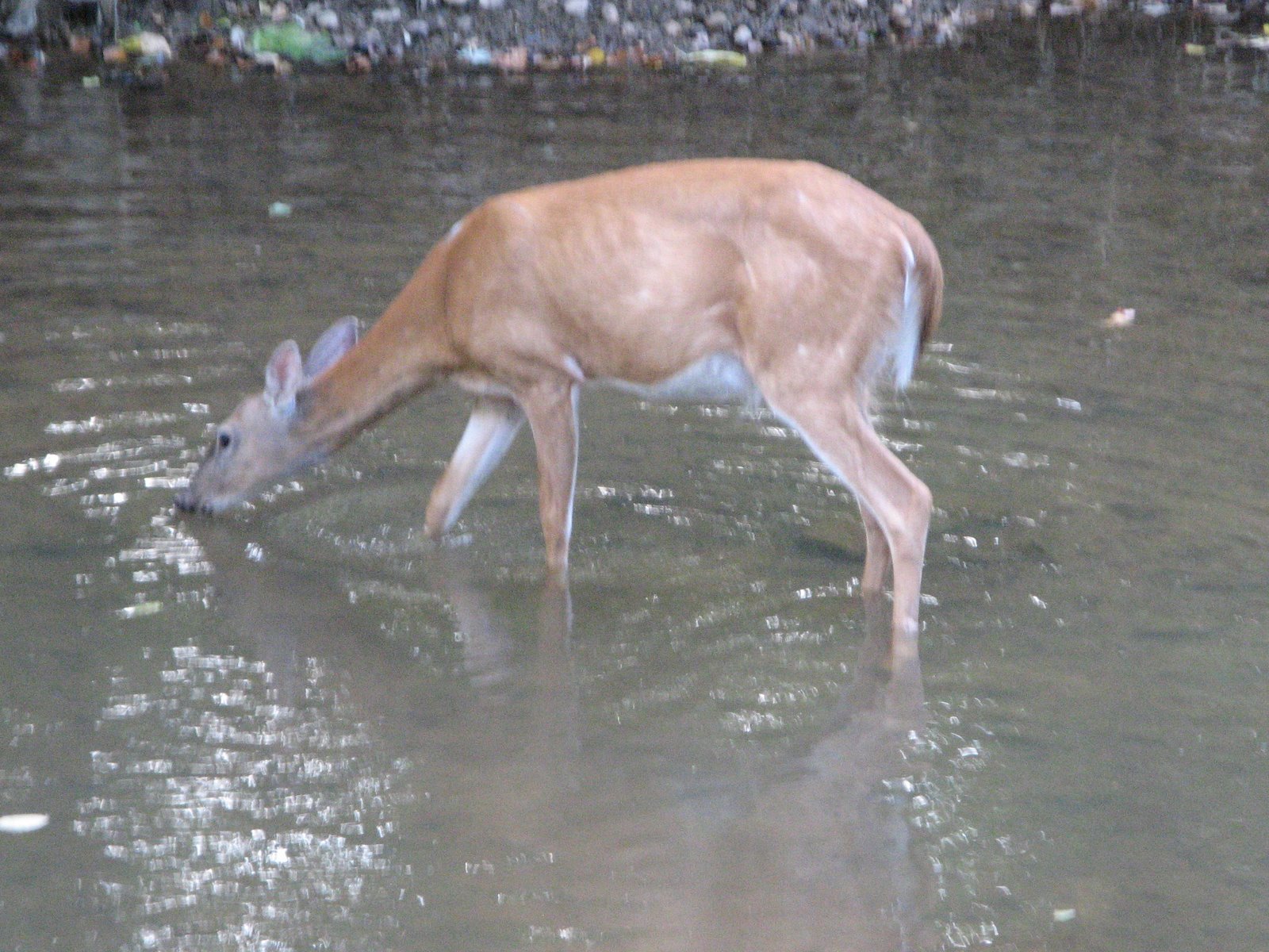
On Thursday, I was testing out the start of a path to work, and I ended up making it as far as the Greenbelt Marriott (green path). The on-road biking was a little bit dicey. I think next time I can go via Rhode Island Avenue and have a calmer experience. On the way, there, I saw a deer cross the Indian Creek Trail and head into the Indian Creek.


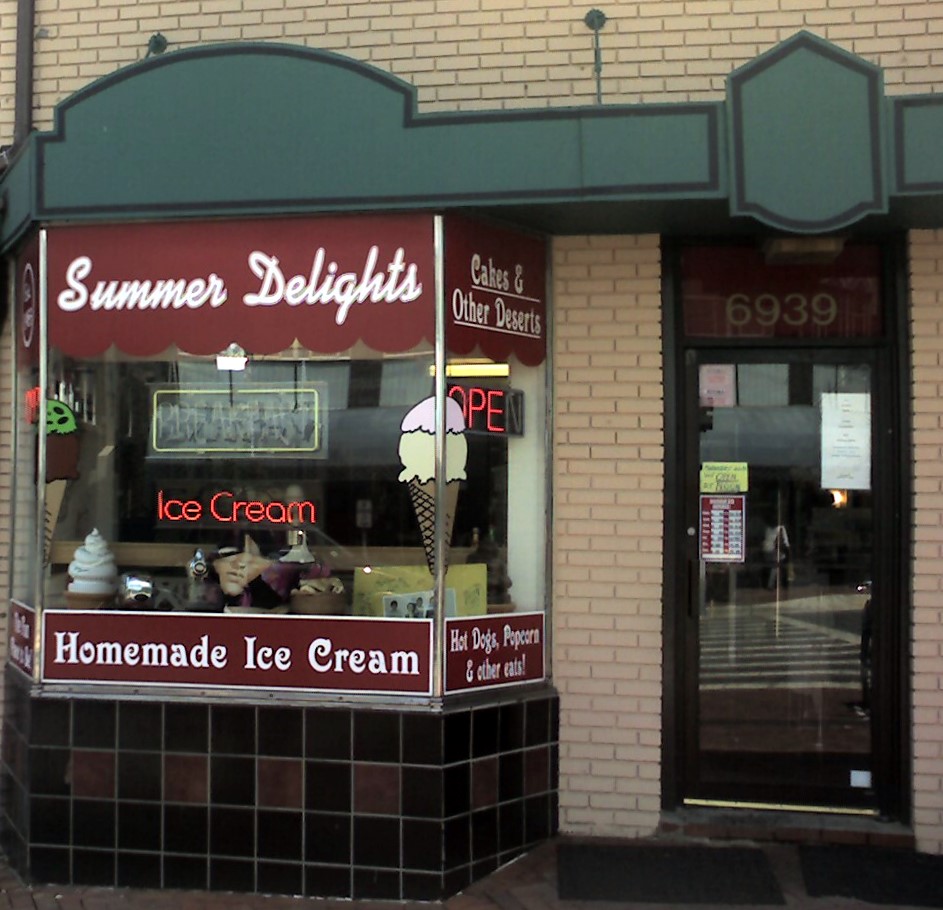
Today I decided to head to Takoma Park (red path, mostly overlapping with the light blue path). That ended up being 7.6 miles, not incredibly shorter than the Silver Spring trip. I enjoyed some ice cream and then headed back.

Saturday, July 11, 2009

Early July Biking


I like the above map as a way of summarizing a bunch of bike rides at once. I've continued logging my trips at Everytrail; links below.

Wednesday, July 01, 2009

This week's biking

I've been happy enough posting my bike trips on Everytrail, so I've stopped putting them here. Instead, I'm going to post weekly summaries and pointers. (The embedding last time didn't work too great.)
 
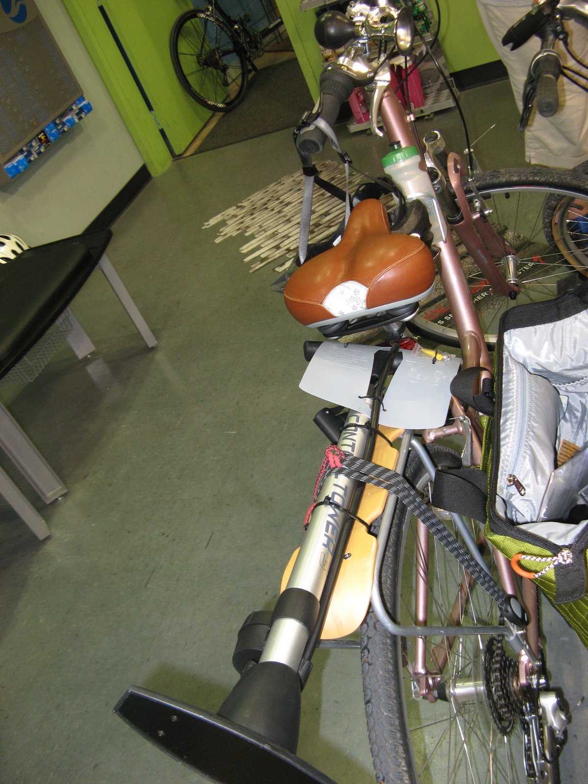
Last Wednesday, we went to Arrow Bicycle to get a replacement inner tube, a full sized bike pump and other accessories. The picture is of the bike pump strapped to Christina's bike rack, since that was the only good way to transport it home.
Thursday morning, I had a quick ride out to Lake Artemesia.
 
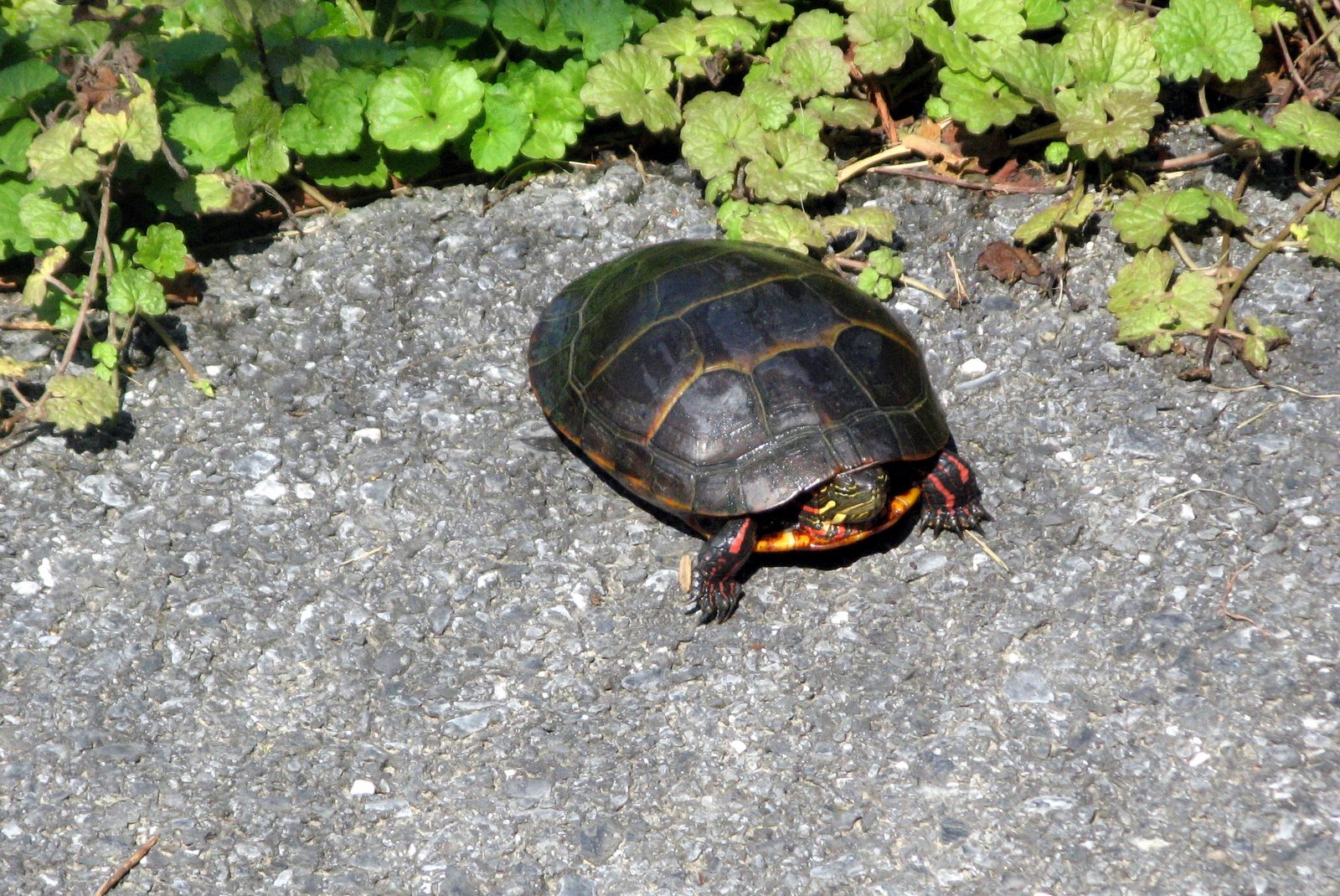
Saturday morning, I rode to the end of the Paint Branch Trail (and saw a turtle).
 
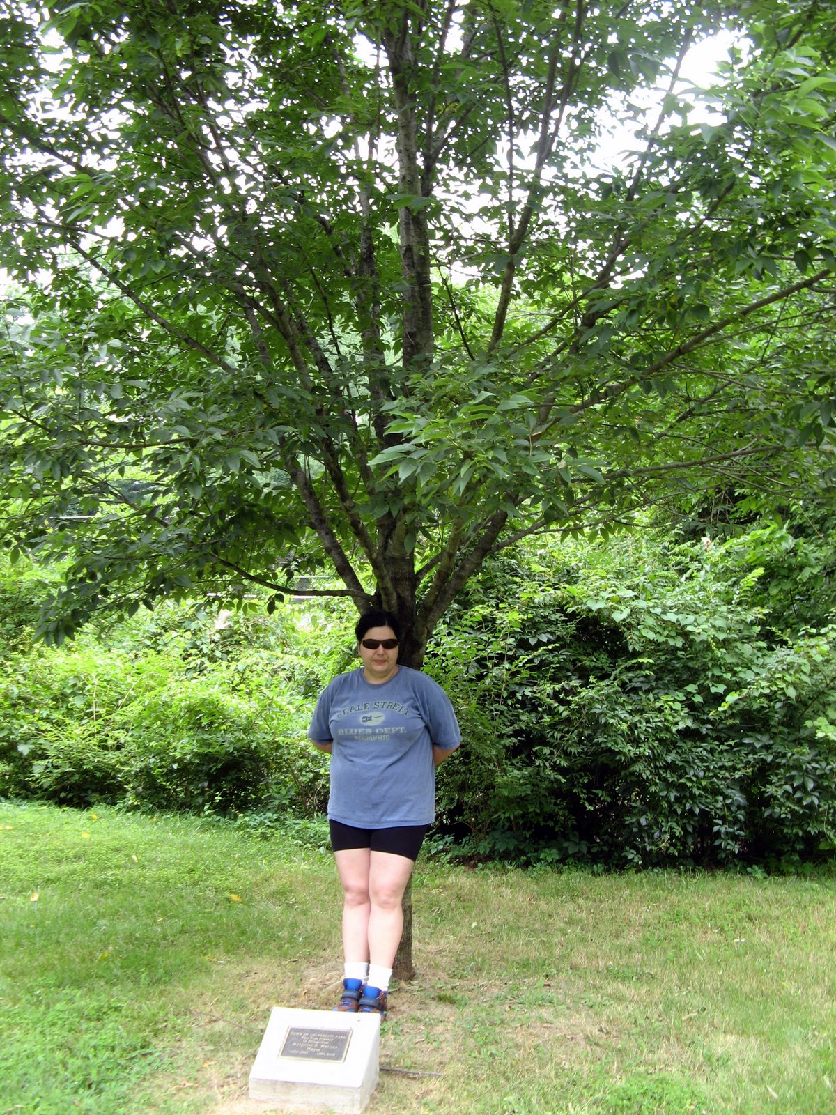
Sunday, we saw a tree dedicated to our former mayor, and looked at some nice houses in town.
 
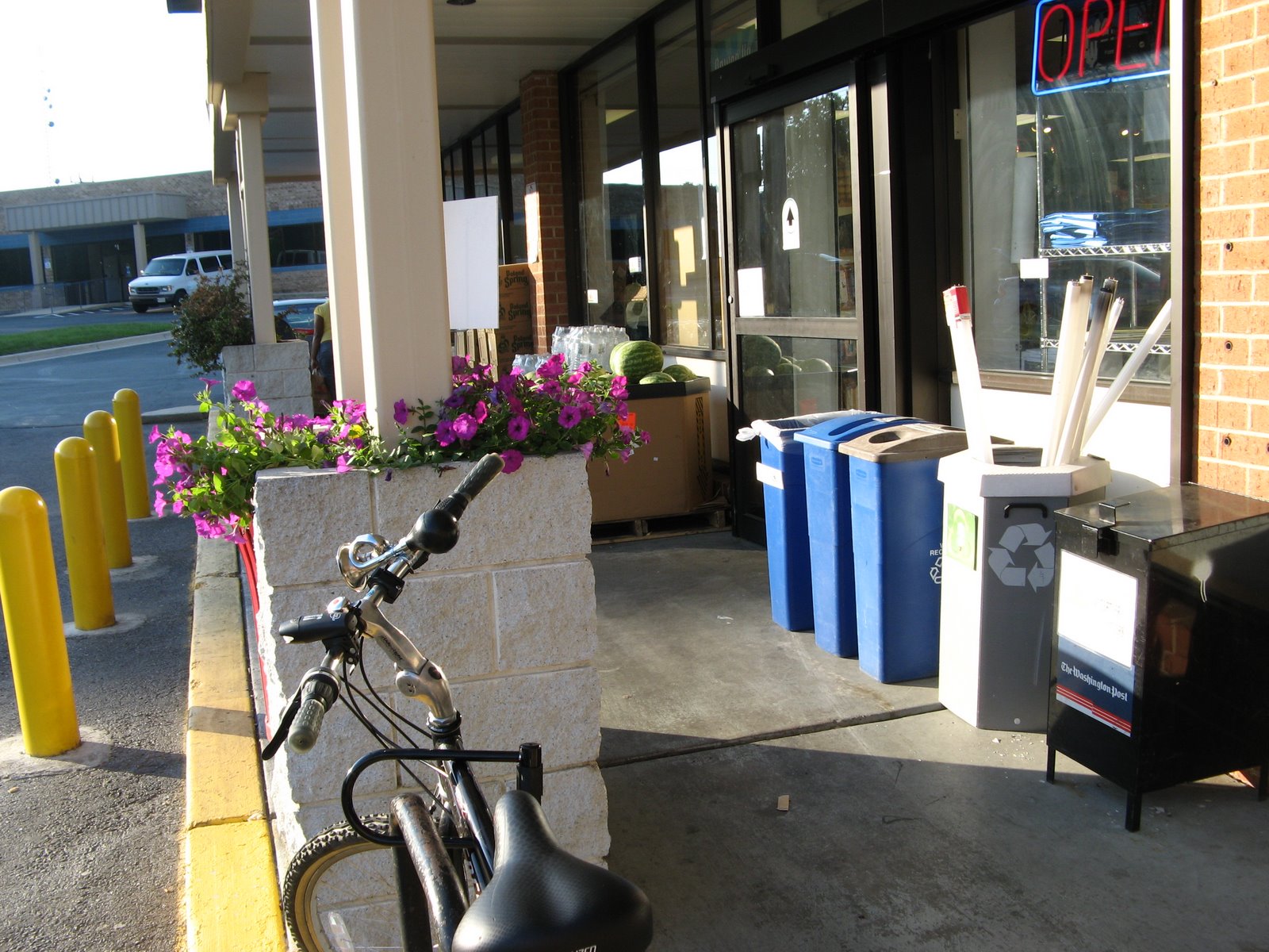
Monday, I rode out to the store and brought back some food (useful biking!). Tuesday, I explored the Indian Creek Trail and other new routes.
Posted by Picasa

Wednesday, June 24, 2009

Flat Tire Ride

Martin yesterday told me about Everytrail an application/website for tracking and sharing your bike rides (and other GPS-tracked activity...hiking, motorcycling, skiing, etc.) I came home yesterday with the idea of riding out to Paint Branch Golf Complex, but the reality was much less exciting. I therefore present to you my first Everytrail ride: Flat Tire Ride.

Flat Tire Ride

Widget powered by EveryTrail: Share GPS Tracks

Sunday, June 21, 2009

Sunday Riding

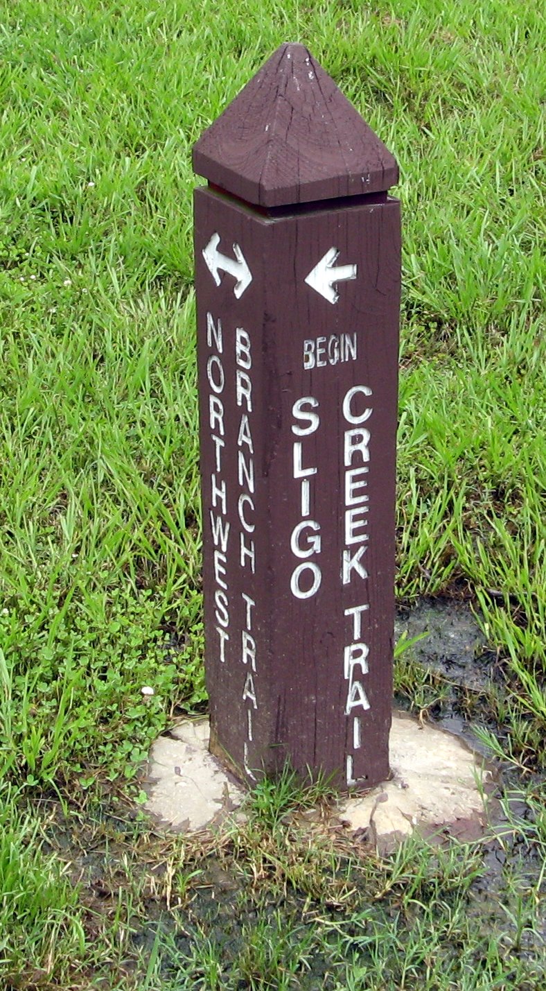
My riding yesterday was divided into two parts. In the early afternoon, I headed to the bike shop for some supplies, including a bell and a rear light. I had a horn, but riding up behind people and honking the horn tending to be overkill. I also needed a rear light that wouldn't pop off the bike (usually at the wrong moment -- crossing the street, headed through a mud puddle). Afterward, I went down to the Anacostia. As you can see, I got confused at first and headed towards the Northeast Branch Trail before doubling back to the Northwest Branch Trail. I was looking for the Sligo Creek Trail, which heads towards Takoma Park and Silver Spring. I passed the West Hyattsville metro station (where the trail system will eventually connect into DC) and made it to Sligo Creek in time to look across the bridge, turn around and head back.

In the evening, I installed the bell and the rear light. I didn't need the bell, but it had gotten dark enough to need the light. I went up the College Park Trolley Trail to the Paint Branch Trail, but when I got to campus, I cut back through the university. It was nice riding past the chapel where Christina and I got married.
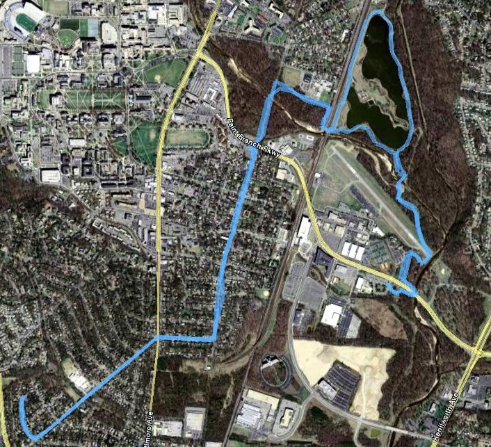
I don't usually like riding along the sidewalk, but it was too dark to turn back onto the trail, and biking Route 1 is a suicide mission. So I hugged the sidewalk through downtown College Park, then cut through University Park to get home as the light was fading.


Posted by Picasa

Saturday, June 20, 2009

Trolley Trail in the Rain

Since we've had continued storms, I decided to avoid paths that seemed like they had danger of mud. That led me to the College Park Trolley Trail. I started out on my usual path and was happy when I crossed Paint Branch Road and got to the less-crowded part of the trail. Since the maps I've been posting are probably not too interesting to those who don't live around here, I broke out my camera mount to take a few pictures.  


Good timing, too, because right after that, a deer crossed the trail.


On Thursday, I turned right towards the University, but today I headed north along Rhode Island Avenue. I was pleasantly surprised that the trail only followed the road for a few blocks before becoming a separate trail again.


After 24 minutes of riding (my GPS tracks moving time and stopped time separately), I made it to Greenbelt Road, a busy thoroughfare that I'd have to walk my bike across. Unfortunately, at this point, the skies opened up, so I decided to head back. Because the rain was, at times, heavy, I tried to see how fast I could make the return trip. 22-and-a-half minutes. Longer, really, since I slipped my chain and spent several minutes getting it fixed with the help of friendly passers-by -- I'll have to do bike maintenance and cleaning on a sunnier day (hopefully tomorrow). Anyway, as always, I was happy to make progress on a new route. Given more time and less rain, it should be pretty easy to make it up to the businesses north on Rhode Island Avenue.
 
Posted by Picasa

Thursday, June 18, 2009

Paint Branch Trail


Today after work, the storms subsided enough for me to get in some bike riding. Since the trails around Lake Artemesia can get quite muddy after rain, I decided to look for another path. So I took the College Park Trolley Trail, but instead of turning right to go to Lake Artemesia, I made a left on the Paint Branch Trail. The trail meets Route 1 near the University -- on the way out, I didn't find the tunnel, so I walked my bike across. It then continues on through the University to the Paint Branch Golf Complex. I turned around right before there (since I wanted to keep my round trip under an hour). It's tempting to see if I can strap a golf club to my bike (note to self: I'll need a golf club for that) and ride up to the driving range. This was an out-and-back route, which I find less interesting than the loops.

As for avoiding the mud, that didn't work so well. There were three places on the Paint Branch Trail where I had to leave the trail to avoid puddles. So I need to wash my bike this weekend. I think next time I may stick to the Trolley Trail, which is mostly on-road.
Posted by Picasa

Sunday, June 14, 2009

8.5 Mile Loop


Well, 8.7 miles, according to my GPS receiver, but next time I won't take the detour in Magruder Park looking for the trail connection. This is a variant of an unplanned trip I took a couple of weeks ago which started out with a trip to the bike shop. This time, instead of taking the usual route through Hyattsville via 41st to hook up with Route 1, I took 40th, which ends at Magruder Park, and then connects up to the Northwest Branch Trail. I took that south to where the two branches of the Anacostia meet, then picked up the Northeast Branch Trail. After a couple of miles, I'm back in Riverdale, and this connects up with some of my usual riding -- around the airport, then past Lake Artemesia. Eventually, I hook up with the College Park Trolley Trail, then cut over to University Park for the trip home. It took me about an hour and fifteen minutes, so it's a good ride for the weekend when I have more time. If I wanted to extend it, I could go the long way around Lake Artemesia. I could also head up the Northwest Branch Trail to see where that went. There's also a short segment heading south.

I'm also glad that I'm getting in good enough shape that this doesn't feel like a ridiculous ride.
Posted by Picasa

Missed it by That Much


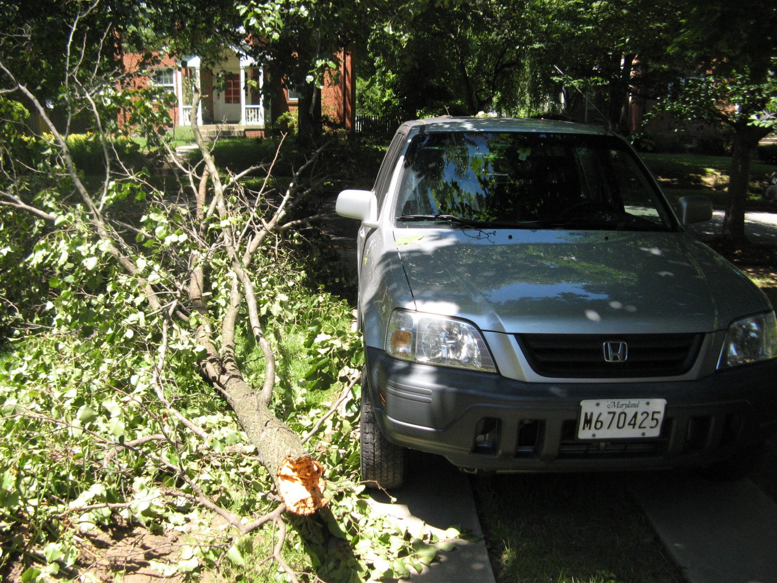
When I went out to my car today to head to the farmers market, I was surprised to see my path blocked by part of a large tree branch. I was even ore surprised to see how close the branch came to taking out my car...some of the twigs were poking into my wheel. Sometimes I feel like I lead a charmed life; a few inches in the wrong direction, and I would be missing a side-view mirror.
Posted by Picasa

Monday, June 08, 2009

Picture from Saturday's Ride


I was just reading Dr. Gridlock's chat on washingtonpost.com when I noticed that someone wrote in linking to a gallery of pictures from Sunday's ride, along with my YouTube video. The above is from the gallery, of course.

Sunday, June 07, 2009

First Crossing


Yesterday was the first day the Woodrow Wilson Bridge was open to bike and pedestrian traffic. Despite the cold I'm recovering from, I decided I wanted to be part of this history. So I met up with a bunch of other bicyclists on the Maryland side. (For those of you from out of town, the Wilson Bridge is the part of the Beltway that goes across the Potomac at a relatively wide point.) Going with a group definitely gave me the confidence to do this, but now that I know the way, I realize that the only difficult part is going uphill to reach the bridge. (Contributing factors may have been my cold, and the fact that I was nervous about shifting the front gear to first based on some recent problems.) I shot the video below from my handlebars.


The organized ride included 4 more miles around Alexandria (or a longer trek to Mount Vernon). Once I realized, though, that I could just turn around and go home, I opted to turn back. Anyway, it's a neat new place to ride...you can look off the bridge at the Capitol and Washington Monument, for example. Hopefully in coming years, Maryland will connect it to more of its trail network.

Saturday, June 06, 2009

View from My Handlebars

My latest toy is a camera mount for my bike. I thought it would be fun to shoot video from the perspective of a bike rider. Below you can see my first attempt. To spare you the ambient noise of biking (hint: "whoosh"), I have replaced the soundtrack with some classical music. Unfortunately, I can't do anything about any motion sickness you may experience watching the video.

Stay tuned for a much more exciting ride that I'm in the middle of uploading now.

Wednesday, June 03, 2009

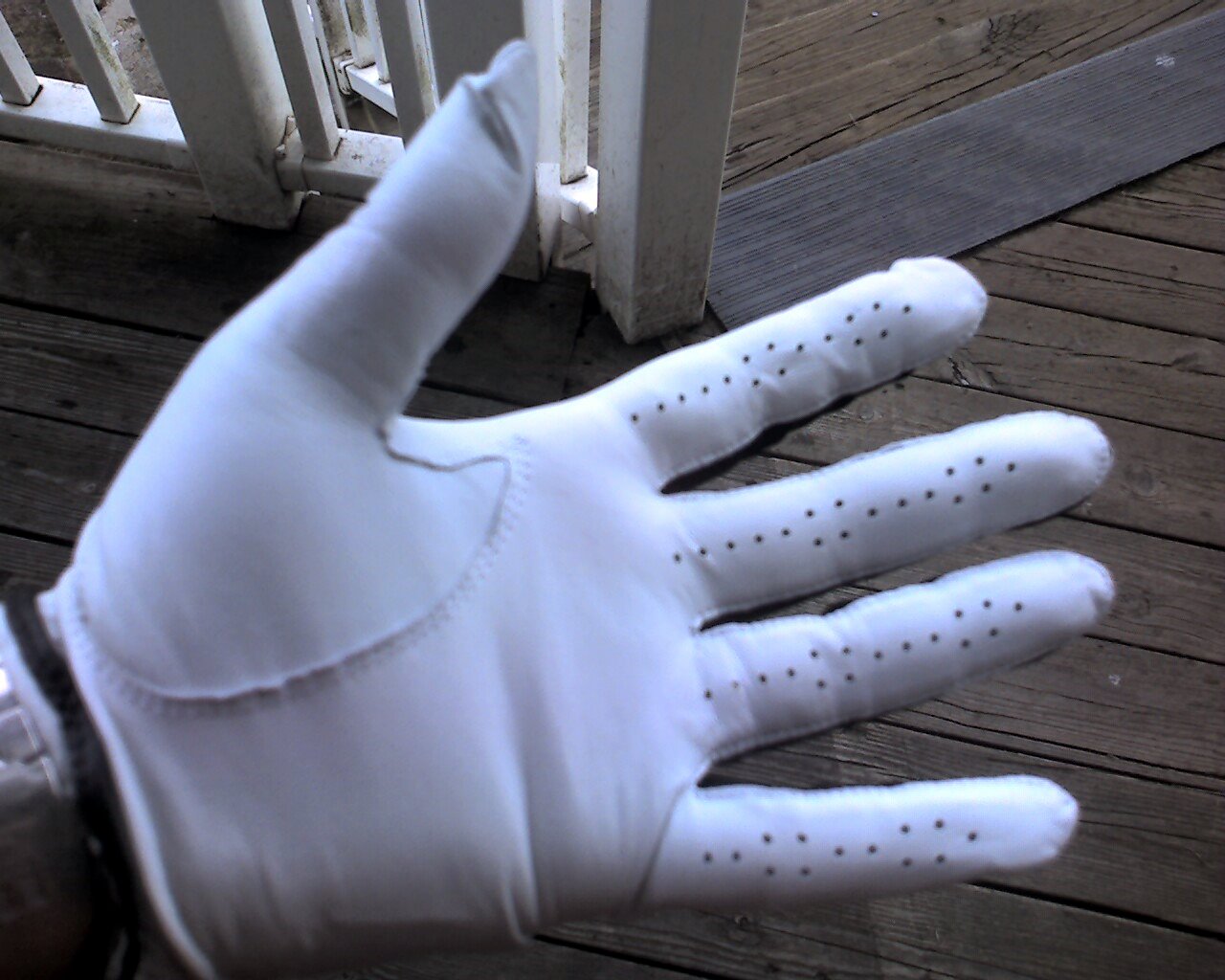
My first (and possibly last) piece of golf equipment

 
Posted by Picasa


I took a couple of golf lessons this week. Christina was set to join me, but came down with a nasty bug on Sunday; hopefully she'll be back on her feet soon. One of my reasons for not taking golf lessons before is that I don't need another expensive, time-consuming hobby. Another reason is that, although I like the idea of continuing education, I am rarely home for long enough to take a class.

With the exception of Memorial Day weekend, I've been home for an extraordinarily long period of time, by my standards. So it seemed to be a good time to fit in a golf class, offered through the Prince George's County parks department.

The first class was fun, partially because half of it consisted of whacking the ball without great concern for accuracy. At the end, though, I had one question for the instructor. "What am I doing wrong if skin is coming off my hand when I hit the ball?"

"Nothing," replied the golf pro. "You'll develop calluses. Or you could get a glove." A $10 glove seemed a reasonable precaution to prevent further erosion of my epidermis...well, it ended up mitigating it, at least.

Today, I dragged myself down there (I have a bit of whatever's laid Christina low), got a glove, and spent 40 minutes hitting the ball. Apparently, the pro's criterion for ending the lesson is the second visible lightning strike. By the end of that time, I was fairly consistently hitting something that looked superficially like a golf shot. (The alternative being the errant shots my classmates were frequently dribbling past my feet.)

So I had fun. I'm not sure I'll pursue this past the four lessons I have remaining. On the other hand, if I had a club, I could visit the driving range from time to time...

Thursday, May 28, 2009

Road-Testing the EyeFi Explore

Picasa Album

This morning on my bike ride, I decided to test out my new wireless memory card. The main selling point of the Eye-Fi cards is that they will wirelessly upload your digital photos to your computer and/or web albums. For me, however, the most intriguing thing about the Eye-Fi is that the Explore modeling will automatically tag photos with geographic coordinates.

How does it do that? GPS? No, actually, it detects wireless networks in the area and compares them versus a map of known wireless networks. If you think, "there aren't enough wireless networks in my area for that to work"...then you're probably wrong.

I tested it out last night in our living room. The first picture I took was tagged as being in the alley behind our house. My thoughts, in order:

  1. Hey! That's not quite right.
  2. Wow! That's actually really close.
  3. Hey! That's actually kinda scary


This morning on my bike ride, I decided to give it a further test. I took pictures at 5 locations. They probably weren't as widely dispersed as they should have been for a great test, but...oh, well.


  1. First, I took a picture while waiting for the light to change at Route 1 and Queens Chapel. One reason I have been riding this route lately is that it's the only light I have to wait for. EyeFi accuracy: within a few feet, it looks like.
  2. Next, I realized I hadn't stretched, so after riding down the steep hill on Amherst, I did some stretching. EyeFi accuracy: a few feet off (it put me on the road instead of the trail).
  3. Then, I decided on something trickier. I rode to the tunnel under the Metro tracks. The tunnel is quite muddy after the recent rains. Yesterday, after braving the mud, I found the way blocked ahead by yellow caution tape. Today, a jogger said that the trail looked open, but I turned around there anyway. EyeFi accuracy: Failure. It defaulted to the previous location. No surprise, since I can't imagine I was near any wireless networks.
  4. On the way back up the hill on Amherst, I slipped a gear and had to turn the bike over to fix it. After my recent bike class, I think I know the problem, but am not sure of my competence to execute the repair myself. EyeFi accuracy: Great. I was especially impressed at the ability to distinguish between this and each of the other nearby locations, half a block away.
  5. I rode back via the University Park tennis courts and took a picture. EyeFi verdict: Failure; it defaulted to the Amherst location. This was a little disappointing, but not shocking.


When I got back, I set my camera down, turned it on...and the first two photos automatically uploaded. Later, I turned the camera back on, and the rest transferred.

Overall, I'm pretty impressed with the EyeFi. I think eventually cameras will need to combine this technology with GPS receivers to get much better coverage, but for now it won't be too hard to clean up the glitches by hand. (I avoided doing so on this set to demonstrate the drawbacks.) Hopefully I'll get to use this in some more exciting locations than College Park soon. Also, I've ordered a camera mount for my bike, so I'm looking forward to trying that out.

PS I just tested the links, and you may have to click on the album itself (rather than the links I've given to individual pictures) to see the mini-map Google provides for each photo.

Sunday, May 24, 2009

Second Saturday Ride


After yesterday's morning ride, I felt invigorated enough to try another ride. After Thursday's unsuccessful attempt to by fruit from the farmers market, I decided to give the College Park Farmers Market a try. Unfortunately, I misread an article about the market, so I didn't realize they closed at noon.

Thus my ride didn't bear fruit (ha) from that perspective, but I did enjoy my longest ride yet. It wouldn't have been so long, except I decided to go the long way around Lake Artemesia on the return trip. It was nice, though on the short way, I did see a deer!

I'm hoping I'm building up some endurance. I am taking today off from biking, but hope to be back in the saddle tomorrow.


Posted by Picasa