Showing posts with label bike. Show all posts

Monday, March 13, 2023

World Heritage: Historic District of Panamá


Catching up on my World Heritage posting, last November I went to Panamá. The one World Heritage site I visited there was the Historic District of Panama City, part of the "Archaeological Site of Panamá Viejo and Historic District of Panamá" site. I took a bike tour of it. (I also took a pub crawl of it, but that's a different story.)

Tuesday, July 29, 2014

Longest Bike Ride Yet (Maybe)

Mile 18.6
On Sunday, I biked in the Firefighter 50 in Carroll County. Despite the name, I was able to choose the 30-mile course. About 5 miles in, I realized that I should not be riding this far without training first. In between this ride and the last 25+ mile ride I did, I only biked once. That's not really a good idea, especially for an out-of-shape guy in his 40s.

Starting at the fire house
Other than the moments where I didn't know if I could finish (I pushed the bike up most of the hills in the last 5 miles), I enjoyed the ride. I prefer the rural cycling to the urban rides I've done the past two times. There's a lot less traffic and traffic signals. On the other hand, there are fewer rest stops and convenience stores, so I will have to remember to pack more water next time.
Mile 23.4, the rest stop

Was this my longest bike ride yet? Last month, I listed my longest five, the longest of which was a 33-mile ride last year. According to MapMyRide, Sunday's ride was 33.09 miles. For last year's ride, I used EveryTrail, which rounds off to the nearest mile once you pass a certain distance. In an attempt to resolve this, I downloaded the GPX file and uploaded it to two different sites that allow you to visualize your tracks. One of them said 30.43 miles; the other said 33.5 miles. I guess it depends on how you interpolate between the waypoints. Let's call it a tie.


The picture above is next to a Maryland Historical Marker. Of the 379 waymarks in that category, I have visited 47, or a little over 12%. That seems like a lot, but it's a little bit skewed by the 14 I've posted myself. (There are certainly more than 379 markers across the state.)


Sunday, July 20, 2014

Bike Ride: Minute 44


Yesterday I signed up for a 30-mile bike ride, which takes places next weekend. Since I hadn't been on my bike since my last long-distance ride, I decided I needed to practice. I went out for an hour, but only managed 5.6 miles. That was partially because I motivated my ride by finding a geocache, which entailed a lot of riding around slowly trying to figure out where I should be. (I am trying to embed the map above, which should show the part where I was spinning my wheels.) The cache I found is named McCrory's, after a store that was in this shopping center many years ago.

The shopping center has become very dilapidated -- there is a rumor that Harris Teeter is in negotiations to come in -- so there weren't a lot of people hanging around, which is good for cache stealth. One of the problems I have with geocaching, though, is that I'm not thrilled with either caches like McCrory's, which are in perfectly icky parking lot settings, or deep-woods caches that require you to bushwhack for half a mile to find them. There are a few that are "just off the beaten path," but they require me to choose carefully.

Still, I was happy to log this one, since it put me one cache closer to my "goal" of finding one in each minute of the 76th degree west of longitude. (I put "goal" in quotation marks, since I find it unlikely I'll ever finish this.) This is my 13th minute.

I looked to see if I could add to my count on next week's bike ride, but it appears to take place entirely to the west of the 77th parallel.

Thursday, June 12, 2014

Tour Dem Parks, Hon


After Sunday, here are my five longest bike rides:
  1. 33 miles in 2013 in Chestertown, MD
  2. 29 miles in 2009 in Switzerland
  3. 28 miles in 2009 in Santa Barbara, CA
  4. 27 miles in 2014 in Baltimore
  5. 25 miles in 2013 in Baltimore
Tour Dem Parks, which I just biked, ended up being longer than last fall's Tour Du Port. Partially because I counted the ride from the car to the start point (and back), and partially because the 25-mile course I selected was actually more than 26 miles long (a fact I realized around Mile 21).

I didn't take any pictures along the route because while it was pleasant and enjoyable scenery much of the way, nothing was spectacular, and I just concentrated on enjoying the ride.

For this ride, I switched from Everytrail, which I had used for previous rides, to MapMyRide. Mainly because I'm participating with a team in the National Bike Challenge. The routes for Tour Dem Parks were posted on MapMyRide, and when I tried to copy it over to follow along, it got logged as participation in the National Bike Challenge, despite the fact that I deleted it (oops).

Anyway, I don't like the MapMyRide trip display as much as Everytrail, so see below a screenshot from the route. The green swaths on the left and right were the nicest parts; the city streets connecting the two were the least nice. I figure any part of the city where people feel the need to put up eight or so "No Ball Playing" signs on every block is kind of rough. (I never felt like there was a problem biking through there, though.)


I wore my Michigan cycling jersey for the first time on this trip. I in general don't feel the need for "gear" (I'm not particularly aerodynamic even with the jersey), but I love the colors. One thing I didn't anticipate was the number of responses it would get from my fellow riders -- probably around 50 shouts of "Go Blue" and similar. Cool. (I guess; as an introvert, I'm a bit ambivalent.)

Thursday, March 20, 2014

Biking to Melford

The author, on his way to work
There is an article in the Gazette today entitled, "Residents voice opposition to new Bowie housing development." I'm one of the residents quoted in the article. Although I'm quoted accurately, I wanted a place to lay out my detailed thoughts on the matter, and well, this is my blog, so here goes.

The Melford Village proposal is a complex and multifacted beast. I am impressed with the attention to detail by both St. John Properties and City staff in analyzing the many aspects of the proposed development. I, however, chose to focus on just one thing -- bike and pedestrian access. I did this for two reasons. One, as someone who sometimes bikes to work at Melford, I know how much bike access needs to be improved. Two, since St. John is touting Melford Village as an environmentally-friendly development, better non-motorized access seems like a good test of their commitment.

I went to the Advisory Planning Board meeting with an open, if confused, mind. I had read through as many of the documents as I could. Some of the documents seemed to show a trail along the Melford entrance, but I could find no commitment to specific connections. In particular, not only was there no assurance that there was improved access to Belair Drive, there was no reference to the proposed trails along 301 in the City of Bowie Trails Master Plan. Those proposed trails would really make Melford Village a lot more attractive to the type of active, environmentally-conscious residents St. John wants to attract.

Once at the meeting, I discovered various items of interest in a handout (that is also available on-line, I just hadn't noticed it). First, at a January stakeholders meeting I was unable to attend, Martha Ainsworth raised a number of concerns, including, "There is no walking or biking connectivity with the rest of Bowie," and
"How can the development be made more conducive to biking, except down Belair Drive, given the two highways that border it? Are biking bridges that cross route 50 or route 3 forseen? One can't bike to any of the stores near the community, to Sport Fit (a mile away), or to Whitemarsh Park without riding on Route 3/301."

St. John's response concerned me. They said,
"The proposed design includes 9.5 miles of sidewalks, 3.4 miles of trails and 1.6 miles of bike lanes within the community. Residents of Melford Village will be able to live a healthy lifestyle without needing to interact with the highways bordering the Village."
It sounded like they had no interest in connectivity with the rest of Bowie.

Fortunately, City staff saw the need for this connectivity, albeit in a form that I saw as insufficient. They proposed 28 conditions for approval. Condition 25 is,
"A pedestrian connection...shall be constructed between the Melford Boulevard/Science Drive roundabout and Kendale Lane in the Kenilworth section, prior to the issuance of the 300th building permit."

I have three problems with this condition.
  1. It should be a bike/pedestrian connection. Given the distances between Melford and the rest of Bowie, bike travel is more realistic than walking for running errands, etc.
  2. It doesn't address connectivity to Route 301, which would give more direct access to commercial features than the Belair Drive connection.
  3. I don't see why it should wait for the issuance of the 300th permit.
I wasn't sure whether I was in the camp of objecting to the development based on the inadequate bike/pedestrian facilities, or saying I'd support it if they were made adequate. Then a representative from St. John objected to Condition 25 on the basis that it wasn't safe for people to walk in and out of Melford. Well, yes, I know that! (Having done so.) The lack of any interest in making it safe pushed me over into the camp of those opposed.

I spoke off the cuff, so I don't remember exactly what I said, but here are the main points I tried to make.
  1. I would like to see Melford succeed with an environmentally-friendly development that is part of Bowie.
  2. In order to be environmentally-friendly and part of Bowie, you need bike and pedestrian connectivity with the rest of Bowie.
  3. It is unrealistic to expect that nobody will want to walk or bike out of Bowie. The developer proposes restaurants as part of Melford Village; I don't expect every dishwasher at every restaurant to be a resident there.
  4. This is not a theoretical concern. In 2011, a Bowie resident biking home from a job in Crofton was killed on Route 301 not far from Melford. 
This will come up before the City Council soon, and I expect to be engaged. I pushed a year ago for adequate connections to the rest of Bowie being a condition for development, and I'm going to keep pushing for it.

Saturday, October 05, 2013

Tour Du Port 2013

Last weekend I rode the 2013 edition of the Tour Du Port, a bike ride through Baltimore. There were 15, 25, 40, 50 and 60 mile options. I felt good to say that I didn't take the shortest option. On the other hand, it looks like the extra 10 miles on the 25-mile ride were just a tour of Dundalk, which wasn't particularly exciting. If you did the 40-mile ride, you got to see North Point State Park, which is probably nice, but the second part of my ride seemed sort of tacked-on.

I don't know how many of my fellow riders were in it for the scenery. At one point, everybody seemed to be ignoring the cue sheet directions, but somehow following the painted arrows on the street. I figured out that the directions had us take about a 1/3-mile loop through Federal Hill Park, and most people just skipped that.

View from Federal Hill Park
The view of the harbor from the park was one of the highlights of the trip, so I don't quite understand that. Patterson Park, Fort McHenry, and the rest stop at the Aquarium were also quite nice.

There's another ride through Baltimore called "Tour Dem Parks, Hon" that I think I'd prefer, if I do another one there next year. While some sights on the urban part of the ride were interesting (someone tailgating in a random street parking space for an away game, a couple still dressed in their going-out clothes after likely having been up all night), I'm not a huge fan of city biking compared to being in parks.

Registration at Canton Waterfront Park
All in all, it ended up being my fourth-longest ride, after the ride in Chestertown in June, the ride in Switzerland, and one in Santa Barbara. I think the only way I could do anything significantly longer is if I knew I'd have a long break in the middle (which I did in Switzerland and Santa Barbara).

It was nice doing two of these long rides this year, and I hope I can do two or three of them again in 2014.

Tuesday, August 27, 2013

Exploring the WB&A Trail, Not Finding a Geocache

On Saturday, while the kids were pretending to try to nap, I went for a bike ride. I started out by heading down Race Track Road. I was glad to try this stretch of road, because although it's labeled as a bike route, I can confirm it's grossly inadequate as such. I didn't feel unsafe, but I would never send a beginning bicyclist out with such a narrow shoulder and with that quantity and speed of traffic.

suddethb's photo of the geocache site
I set out in search of Horselover Bridge, the closest geocache to our house. After ten or fifteen minutes of fruitless searching, I gave up and headed on. The cache is located near a guardrail that was the recent site of an automobile accident. People have found the cache since the accident, but I couldn't.

The search reminded me of a lot of things that I don't like about geocaching -- standing by the side of the road, searching for a pill bottle while cars whiz by isn't my idea of fun. On the other hand, trudging through the woods and attracting ticks isn't so great either, so I don't know where that leaves me. Perhaps being picky about which caches I look for?

I biked on a little further to the start of the Prince George's County section of the WB&A Trail. If they'd just build the dang bridge, I could have headed into Anne Arundel County here, but I only had one option.

I had previously only biked (or walked) as far as the turnoff for Old Town Bowie, just over 197, so I was eager to see what lay beyond. First, some farms, and then a nice, flat ride past some suburban back yards. Every time I would envy them their easy access to the WB&A, I would look up at the power lines looming above their houses, and the feeling would pass.

I turned around once I reached Hillmeade Road (just because I needed to pick a place).  For future rides, I would like to take the trail a couple of miles further to its end, as well as seeing if I can find anywhere worth riding to via the trail -- perhaps via Highbridge Road.

Monday, June 24, 2013

Longest Bike Ride Yet

Bettertown/Chestertown Loop at EveryTrail

If things had gone according to plan, this might have been my third-longest bike ride rather than the longest. In September 2009, I biked 29 miles in Switzerland, and in August 2009, I biked 28 miles in and around Santa Barbara. So when I decided to sign up for the 28th Annual Bay to Bay Ride, I chose the 27-mile (shortest) route.

Some background: the Bay to Bay Ride is a charity ride organized by the Chestertown (Maryland) Lions Club. Riders (some of them) ride from the Chesapeake Bay (Betterton, MD) to the Delaware Bay and back. Even the 50-mile ride doesn't get you out of Maryland; that requires 78 miles. For those who want a loop rather than out-and-back, the 86-mile ride take you back through Chestertown, and the 104-mile ride gives you an extra detour if you want to claim a "century" (hundred-mile bike ride).

As I parked a little before 8:00 and started stretching, I noticed that not only did most of the other riders have road bikes, but nobody else sported the type of large saddlebag that I had (most had backpacks). I think that if I do something like this again, I'll try to pack lighter -- rely more on the food stops versus packing my own extra food and water, and maybe replace my U-lock with a cable lock (I didn't even need a lock on this ride, but it's nice to have one just in case).

I headed to registration to pick up a cue sheet (turn-by-turn directions) and my t-shirt. Looking at the cue sheet, I realized another mistake (besides overpacking). I hadn't brought my handy Garmin GPS unit that had accompanied me on my other trips. I figured I would track the trip with my phone, which has some fairly nice GPS features.

Well, 1) I didn't get data service in Betterton, and 2) I don't have a bike mount for my phone, so I can't stare at the "odometer" and know when to turn. (We'll get to #3 later.) But I figured that since the route was marked with arrows, I'd be OK. Unfortunately the green (27-mile) arrows pointed away from all the other arrows, so I didn't have masses of bike riders to reassure me I was headed in the right direction.

The first few miles were a nice ride -- a bit hillier than I expected from the Eastern Shore, though. I was a bit disconcerted when I came to an intersection and encountered some other riders headed the opposite direction from me. On the other hand, they took different paths from there, so clearly some of them were lost, and who was I to say what paths the non-green arrows led people to? I looked down and saw green arrows -- so I had to be headed the right direction.

It was not a good sign, however, when I crested a hill and saw the starting point. Oh. So I had cut back over to the return route and was following those arrows. After a conversation with one of the ride organizers, I realized that I had made a left when I should have made a right. (Hence the five-mile loop at the top of the map.)

From then on, I was able to follow the arrows -- once you know what you're looking for (tiny painted arrows on the pavement at almost every intersection), it's not so bad. But it was somewhat dispiriting to have to start over again knowing that I was now headed towards more than 30 miles of biking.

I retraced my steps, and after 2.5 miles, made the correct turn this time. It was a nice enough ride past farm after farm, and when I got to Still Pond Creek, it seemed like a nice body of water. About 7 miles in (for the rest of the post, when I refer to mileage, it's on the 27-mile route as planned, not counting detours), however, it started to rain.

I had checked the weather on Friday, and no rain was in the forecast. I was worried about the heat, so I wanted to finish before it got too late, but not about the rain. I hadn't packed any rain gear, and my phone didn't really appreciate the rain (disadvantage #3).

Fortunately, Christina had picked out a really snazzy saddlebag for herself -- which unfortunately for her, didn't fit her bike. I inherited it, and it has a snazzy rain cover. So I tucked my phone, my wallet and everything but the cue sheet inside the saddlebag. I was soaked, but my belongings were fine. (I was impressed at how well the phone's GPS continued to track my path.)

As I biked into Chestertown, the rain let up, and I passed various strip malls. I had the feeling driving in that Chestertown had a quaint waterfront, but I didn't end up seeing it. Farther into town, though, I passed Washington College. I was very amused to see signs for "CTY registration." Thirty years ago this summer, I spent the first of four summers at the CTY programs in Pennsylvania, where I studied math, science and other academic pursuits. At the time, there was no Chestertown location, but if there had been, I could have been here!

Fourteen miles into the ride, I was at the turnaround point. I was invited by the cue sheet to take "A Walking Tour of Old Chestertown." What I really wanted was a bite to eat, though, and I saw that a food stop was available at Mile 16.

Food Stop
So I headed back on the return journey, and made a little detour to the food stop, which was in front of an assisted living home. There, I saw a lot more bicyclists than I had the entire trip. So there were other people on the green route. (I think the 86-mile route also passed by here, but it was around 11, and most of those riders had not made it back yet.)

Still Pond
For some reason, I was expecting a more elaborate spread, but there were some bananas, cookies, and the opportunity to refill water bottles. I was pretty happy with those choices, actually. I had overestimated how hungry I'd get and weighted myself down with two boxes of granola bars.

The ride back was nice, though it started to rain again. At the 23 mile point, I passed through the community of Still Pond, which was the first in Maryland to grant women the right to vote. That was one of three historical markers I saw on the ride, but it hadn't been waymarked, so I submitted it.

I made it back to the starting point a little before 1:00, as the clouds started to part and the heat began to bear down. My phone counted it as a 33-mile trip. A little bit of that might have been GPS "jitter", where it thinks I've moved because the reading is off, but looking at that map above, it looks pretty straight.

I'd love to do this again some time, although likely in a different venue. I'm sort of picky about which rides I'll do -- for example, I'm happy to donate a registration fee to charity, but I'm not going to hit friends up to sponsor a ride. I also don't want hills, a long drive to get there (at almost two hours, this one was a bit much) or a ride over 30 miles.

So I've got my eyes set on the Tour du Port in Baltimore in September. The 25-mile ride isn't even the shortest one available, and hopefully I can convince a friend or two to come along.

Saturday, March 16, 2013

Project Bike To Work: Daylight Savings

I decided that the first Wednesday after Daylight Savings was a good day for my first bike ride to work of the year. On Thursday, I got an e-mail about my activity a year ago (the first Wednesday after Daylight Savings), indicating that it was my first bike ride to work of the year. So I guess it's a tradition!

I have had a somewhat sedentary winter, and my goal is to turn it around, in part, by biking to work at least once a week. I understand that a weekly 8-mile round trip will not, in and of itself, burn a ton of calories. But I'm hoping it will inspire me to take the bike out some more -- figure out how to attach the trailer we bought around the time the kids were born, for example.

Also, at some point I decided that diet soda wasn't any better for me than regular soda. Unfortunately, I took this to mean, I might as well drink regular soda instead of Pepsi One or whatever. But I have found that when I ride my bike regularly, I don't really want to grab a Big Gulp and undo many of the positives.

Before I set out Wednesday morning, I weighed myself -- 217 pounds. I really should be under 200, something that hasn't been true since the 1990s. I figure if I have monthly posts noting how I'm doing on biking to work and on my weight, it'll help keep me to my exercise plan. From June 2006 to August 2009, I tracked my weight on a spreadsheet. Until June 2009, it was almost always above 217, so I guess things haven't gotten worse for me in the past 4 years.

Anyway, if I am going to bike to work more, I should try to make good time. Google Maps says it should take me 22 minutes to get there, and 23 minutes on the way home. I did not properly time myself, but I think I was more like 25/30. That should come closer to the ideal times once I'm in better shape. And that's only 10 extra minutes each way over driving, which seems a reasonable compromise.

Saturday, March 09, 2013

Melford Testimony

This Bowie Patch article is about the Bowie City Council approving amendments that would allow residential development at Melford, the office park at which I work. I spoke during the public comment section preceding the vote. I didn't think it would do much good to tell the Council my opinion on whether the development is a good idea -- for one thing, they seemed to have their minds made up. For another, as left-wing as I am about some things, I think that businesses have the right to try out their own business plans without the government having to figure out whether they're going to succeed. So I focused on the impact on the City of Bowie, and I chose to highlight one particular impact. From the article:

Jon Grantham, who works in the Melford office park, moved to Bowie so he could be closer to work and appreciates the idea of people wanting to be close to their jobs. Grantham said he sometimes bikes the four miles to work at Melford and that currently, the property is not very pedestrian or bike friendly.

“When you get to the end of Belair Drive and you enter Melford Drive it becomes, and there’s no better word for it, scary,” Grantham said, citing a lack of side paths and sidewalks.

The development, said Grantham, is currently so automobile focused, he’s concerned it could never be pedestrian friendly. He suggested the city make connecting bike paths and trails connecting Melford to the rest of Bowie mandatory in the development to increase connectivity and pedestrian safety. The connections Grantham mentioned are suggested in the city’s Trails Master Plan, adopted in 2002.
I didn't think I actually gave the impression that it could never be pedestrian-friendly, but I guess I do have that skepticism, so maybe it came across. I mean, the closest restaurants by walking distance (other than the on-site cafe) are 2.6 miles away, according to Google Maps. I'm sure the developer would love if residents could only walk to on-site dining options, but the glaring visibility of that fact would probably keep some number of residents away.

Anyway, here are my remarks, as prepared. I deviated significantly from them in places, not always to great effect.
Greetings, Councilmembers and Mayor Robinson. Thank you for the opportunity to speak to you today.

My name is Jon Grantham. I first worked in what is now known as Melford in the summer of 1989, and I have worked there full-time since 1997. I am not speaking on behalf of my employer, rather for myself and for my family.

We bought a house in Bowie in large part to be closer to my work so I could spend more time with our twins. I sometimes make the 4-mile commute on my bicycle -- once I even walked it. The first three miles are very pleasant. Levitt really knew how design an attractive community. Where Belair Drive ends and Melford Drive begins, however, it becomes -- there’s no better word for it -- scary. There are no sidewalks or side paths, and bicyclists and pedestrians are forced to merge with traffic which has just exited major highways.

I do not understand how St. John Properties proposes to build and market a pedestrian-friendly and environmentally responsible community in a part of Bowie so dependent on automobile traffic, and which is so cut off from the rest of the City.

The City’s 2002 Trails Master Plan shows proposed trails connecting Melford to the rest of Bowie. The trail along Melford Drive is the most direct link, but the ones along Crain Highway would connect the proposed community to Whitemarsh Park to the north and retail to the south.

I believe that unless the City explicitly makes this connection a requirement of approving a site plan, all the talk of green development will be just a joke. Please only approve these amendments if you intend to make sure this development is compatible with the rest of Bowie and its green principles. That means a development with bike and pedestrian trails that connect to the rest of Bowie.

Saturday, November 12, 2011

Project Bike to Work: New House

Project Bike to Work: New House at EveryTrail
EveryTrail

For the first time since we moved to Bowie this summer, I broke out the bike and took it to work. It's now too late in the year to do this on a regular work day -- I don't have enough daylight to stay at work late enough. But yesterday was Veterans Day, and I had some hours to make up, so I thought I'd give it a shot.

It actually worked pretty well. The GPS receiver cut out a couple of times on the ride in, but it looked like it took 21 minutes to get there, and 25 to come back. Not bad, since 25 minutes was my old commute by car. It feels like it was more uphill on the way back, but the elevation data I got is a little bit all over the place, so it's hard to tell.

It adds less than half an hour to my round-trip commute, which means, weather permitting, it'll be worth doing on a regular basis. One thing I find funny is that the last 90% of today's trip is the last 20% of my ride from University Park from last year's Bike to Work Day. I hadn't realized that until I looked at the old map.

I also like the route because it's a reasonable one to take by car. It's nice to be on 30-mile-an-hour or less streets for all but a little part near the end, and it saves on gas to take a direct, but lower-speed route. There's an alternate bike-only route I hope to try some time that involves a trail for a few minutes, though -- that could be nice.

It was a bit cold and windy on the ride -- I don't appreciate the burning sensation the cold air produces in my throat. But it was good to do this, and I hope to start exploring more of the area by bike.

Wednesday, April 27, 2011

First Bike Ride of Spring

On Saturday, while the kids were napping, I went for my first bike ride of the spring. I tried to do some geocaching at the College Park Airport, but I could not find the geocache.
Since time was short (and the kids were probably going to wake up), I tried to cut through Riverdale. Unfortunately, there was a train stopped on the tracks.
Not knowing how long this would last -- there have been a couple of human-train collisions in the area recently -- I headed through Hyattsville. When I got to the train bridge underpass over the Northeast Branch, I saw the train moving at about 10 mph. So it probably would have been faster to wait. And my legs would have thanked me. But this was a nice ride, and a good workout (about 10.5 miles).

First Ride of Spring at EveryTrail

Tuesday, November 23, 2010

Two More Geocaches


I've found two more geocaches this month, bringing my total for the year to 3.  Not too impressive, but it matches my total from 2009.  (Of course, last year, I did them in three consecutive days in two countries, which was a bit cooler.)

On Veterans Day, I took a bike ride around my usual 8.5-mile loop of the immediate area.  There are at least 4 geocaches on that loop, one of which was the first of my 2009 finds.  With the aid of a USB charger that takes AA batteries, I powered my phone for the drive and took off after one of these caches.  It was a nice combination of having my Garmin GPS receiver loaded with the coordinates and being able to use the Android phone app to get details once I got to the cache.  As much as I'd like an "all-in-one" solution, this method works pretty darn well.

Spoiler alert: the cache was located just off the trail in the tree stump pictured.  I dropped off Free State Generic #3, my latest geocoin and picked up Montana Plata, a similarly state-themed trackable.


Yesterday, while on my way to pick up our Thanksgiving Turkey from a Frederick County farm, I had a rare opportunity to add a new Maryland county to my list.  There is a virtual geocache in Mount Airy, based around the town 9/11 memorial.  Below is a picture of the memorial plaque, cropped to remove the information needed to log the cache. 

Mount Airy is in Carroll County, which gives me my 9th Maryland county, as shown on the map below.  In July 2008, I noted that I had 122 virtuals (and similar) within 70 miles of home left to find.  Mainly due to the addition of earthcaches, that number is now up to 137.  I may have to reconsider my goal, given my reduced time for traveling up to 70 miles and the news that virtual geocaches may be reintroduced in some form.


Saturday, May 29, 2010

Biking into DC

I had taken this approximate route as far as Peirce Mill in Rock Creek Park before. This time, I decided to keep going and hop on the Metro when I was done. I took the path as far as the Potomac, and I was prepared to finish at the Foggy Bottom Metro. But, hey, I was in DC by the monuments, why not ride around? So I headed up Constitution, past everybody who had gotten into town early for Rolling Thunder, and then to the Archives/Navy Memorial Station. That allowed more sight-seeing, a delicious frozen mango treat, and a straight shot home on the Green Line. A version of this trip is also available at Everytrail.

Saturday, May 22, 2010

Bike to Work Day

Yesterday was Bike to Work Day, and I achieved a goal I've had for the past year of actually biking to work.  I ended up biking 20 miles in about 2.5 hours.  If you don't count the stops, I averaged 9.5 mph, which is pretty good.

(Note: a version of this post with cooler maps is available at the Everytrail site.  I am, however, trying to make sure that I have versions of things I carry about on my blog, since Blogger makes it easy for me to download a backup of my entire blog.  With other sites (I'm looking at you, Facebook), I feel like my history is out of my control.)


I left home around 7:30 and swung by the College Park Bike to Work pit stop.  I got my free t-shirt, and I won some arm warmers in a raffle.  Well, I won a choice of items, and I already had the other items.  I think there's a reason I didn't already have arm warmers -- it's called a long-sleeved shirt.  I munched on a free bagel, and then I had the guy from REI check out my bike (it was fine) while I digested the bagel.

I cut back to the Trolley Trail to Paint Branch Parkway, which became Good Luck Road.  I was on Good Luck Road for a large portion of the total trip.  I passed a bunch of NASA test facilities, which I think finally revealed to me the origins of the name of the road.  I didn't have too much trouble finding my way on the part of the trip that I hadn't done before, but I got in a little bit of trouble trying to find a shortcut from Old Town Bowie to 197...I ended up by some very nice horse farms with a "No Tresspassing" sign that seemed to block my way to the WB&A Trail.  The total distance for the detour wasn't too bad, but the hill was.

After a couple of miles on 197, I was on the mean streets of Bowie, which provided a very pleasant ride on suburban residential streets.  It was exhilarating knowing how close I was to my goal.  Finally, I pulled up to work, loaded my bike on my pre-positioned car, then went into my office, grabbed the clothes I had left there, showered, and did some work.  Can't wait 'til next year!

Thursday, October 22, 2009

New Sign at Trolley Trail/Paint Branch Crossing


This morning I noticed some new signs at the long-problematic crosswalk where the Paint Branch Parkway meets the College Park Trolley Trail. Despite the button-activated flashing lights, there have been a number of accidents at the crosswalk. Various solutions -- a stoplight, speed cameras -- have been proposed, but instead we get this sign (and another one on the other side attached to the flashing lights).

Three things occur to me about these signs.

  1. The advice is probably sound.
  2. That's not how a crosswalk is supposed to work.
  3. They provide a way of blaming the next pedestrian or cyclist who is hit by a car. "Clearly, he didn't wait for the vehicle to stop, or he wouldn't have been hit."

Saturday, September 12, 2009

Halfway to France (and Back)

Last month, I told you about biking halfway to Mexico. Yesterday, I had the pleasure of biking halfway to France. I borrowed a bike from Lausanne's free bike rental program and headed along the lake to Vevey, about 10-12 miles away. It looks like if I had continued around the circumference of the lake, another 10-12 miles would have put me in France. I suppose biking all the way around the lake would make a good vacation, but since all I had was a free day after four days of conferences, this trip was a nice diversion.


For a more detailed analysis of my route, you can check out my Everytrail post. Here's what I had to say about the ride there:
I should have taken the Metro to the Ouchy station near the lakefront, but I let the guy talk me into riding my bike. Of course, I couldn't understand his directions in broken English and ended up riding all over the place before getting out of town.

Once I got out of town, however, the ride was great. There is a main road near the lake, which has bike lanes most of the way, but occasionally there were detours. At one point, I rode through a medieval town center, and at another point, the route rose through the terraced vineyards that hug the coast. I could have reached out and grabbed the grapes. (I didn't.)

When I got to Vevey, I visited the tourist information center, ditched the bike, and headed out. The woman in the information center claimed that there was nowhere to lock my bike, but that I didn't need to. She also sent me to a mall when I asked about souvenirs, so I'm not sure of the quality of her advice. I locked the bike to a sign, which seemed to work. I had lunch at a Thai restaurant, bought some postcards and visited Charlie Chaplin's grave. All in all, a successful visit.

On the ride back, I tried to minimize my detours, not entirely successfully. I had an idea of leaving my bike at Ouchy, then returning for it via Metro after rush hour was over. I really wish I had done that; I meandered all over town trying to find a good route back to Roule Lausanne. Eventually, I did and left tired after my longest bike ride yet.


I should note that both the tourist information center and Chaplin's graves are waymarks, which allowed me to find them more easily. I now have the "grave of a famous person" category. While that doesn't help me with waymarking bingo, it does bring me up to 251 waymarks.

Also, the Lavaux vineyard terraces are a World Heritage Site, which makes them the 46th that I have visited, and the 2nd for 2009.

Finally, here is a link to a Picasa album I made up with some selected pictures from my trip. Now it's off to change my remaining Swiss Francs into British Pounds and find the gate for my plane...

Switzerland

Wednesday, September 09, 2009

In Search of the Northwest Passage


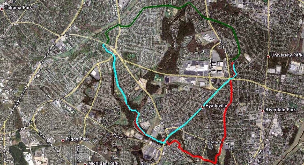
I've been trying to find a good bike shortcut to Takoma Park and Silver Spring. Driving, we have a more-or-less straight shot up East-West Highway, but that isn't suitable for driving. And once I get close, the Sligo Creek Trail and various on-road bike routes make things easy. But it's tricky handling the distance between home and where the East-West Highway hits Sligo Creek Trail.

Fortunately, I collect lots of data about my rides, so I can make both an objective and a subjective comparison.

My first attempts (red path) were done by going south through Hyattsville and Magruder Park and taking the Northwest Branch Trail to the Sligo Creek Trail. It's somewhat roundabout, but it's all easy biking on either residential streets or a scenic set of trails. Time: 31 minutes. Distance: 4.6 miles.

From the first time I looked at the map, I had my eye on a route via residential streets to the west of home (green path). Christina and I explored the route via Wells Parkway and Wells Boulevard to a park we call "Stolen Mulch Park". (The first time we drove by, we saw some women helping themselves to some mulch that had been clearly placed for park use.) One day I decided to push through along the route marked on my bike map. Unfortunately, this route involves crossing Riggs Road, but not at a crosswalk. Riggs Road is fairly busy and doesn't feature many lights or crosswalks. It does have a median, so I did eventually get across, but it was not fun. The only thing this route has to recommend it is that it is the shortest-distance one I tried. Time: 25 minutes. Distance: 2.9 miles.

When I looked at the map again, I saw Queens Chapel Road marked as a bike route (blue path). I had been fairly skeptical, because I know Queens Chapel is fairly busy outside of University Park. When I rode down it, however, I realized it has a nice, wide shoulder. Except for a small segment where people park cars on weekends, it's fairly easy to avoid most traffic before picking up the Northwest Branch Trail. It's a bit hillier than other routes, and not as scenic as going via Magruder Park, but it's the fastest route, and it doesn't involve any scary intersections. If I'm trying to make it farther into Montgomery County, I'll definitely take this path; if I'm looking for a more leisurely ride, I'll probably go via Magruder Park. Time: 22 minutes. Distance: 3.6 miles.

This analysis may seem like overkill for differences of at most 9 minutes or 1.7 miles. But those differences are doubled for a round trip and definitely make a difference between a reasonable ride and one that leaves me feeling wiped out. So, until the county wises up and builds a better path, I think I have the information I need.

Posted by Picasa

Sunday, August 30, 2009

Biking Santa Barbara


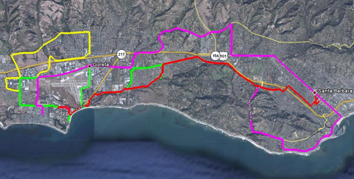
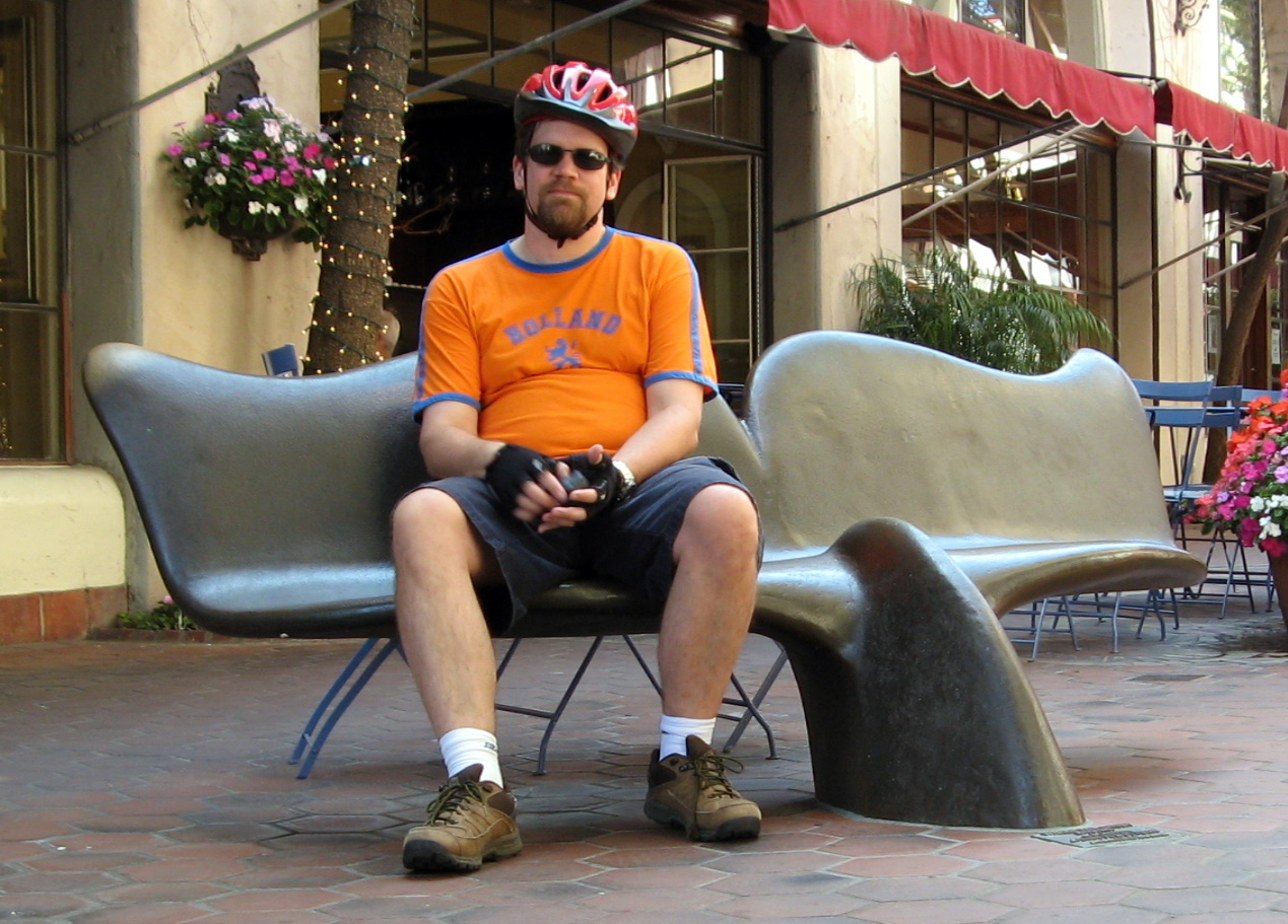
I rented a bike when I was in Santa Barbara for a conference earlier this month. I got in over 80 miles of biking in 4 days, so it was more than I'm used to doing. One day I did 27.9 miles, a personal best (and an exhausting one). The weather was cool, the terrain was flat, and the bike paths were well marked -- all conducive to lots of riding. Two of the days I just rode around near campus on breaks from the conference. Two of the days, on the other hand, I had free afternoons and challenged myself to ride from campus to downtown Santa Barbara.

Both times I did some waymarking...I made it up to 250 categories (from 202 in February). I thought the bike would be great for waymarking, but there were so many waymarks close together, the bike was a nuisance. (Or the waymarks were.)


Posted by Picasa

Tuesday, August 04, 2009

Halfway to Mexico (and Back)

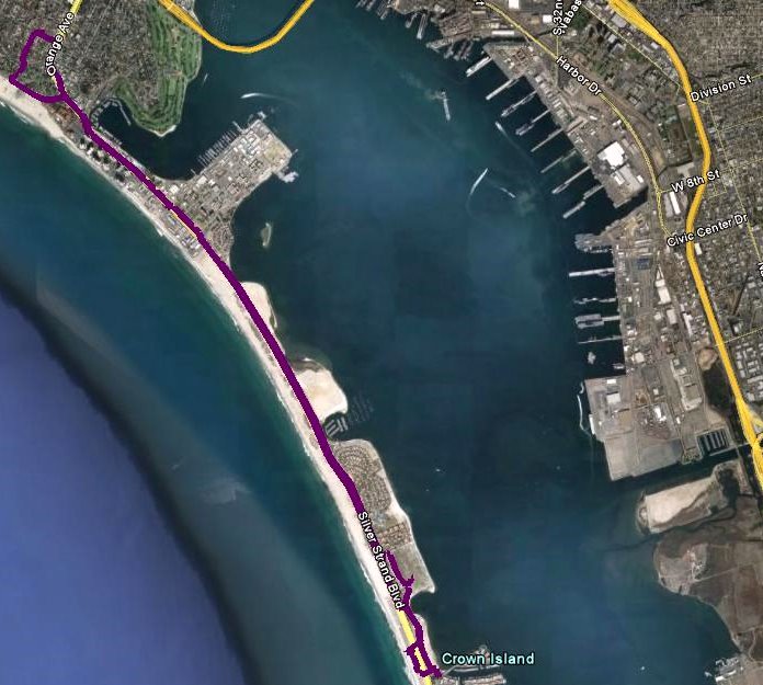
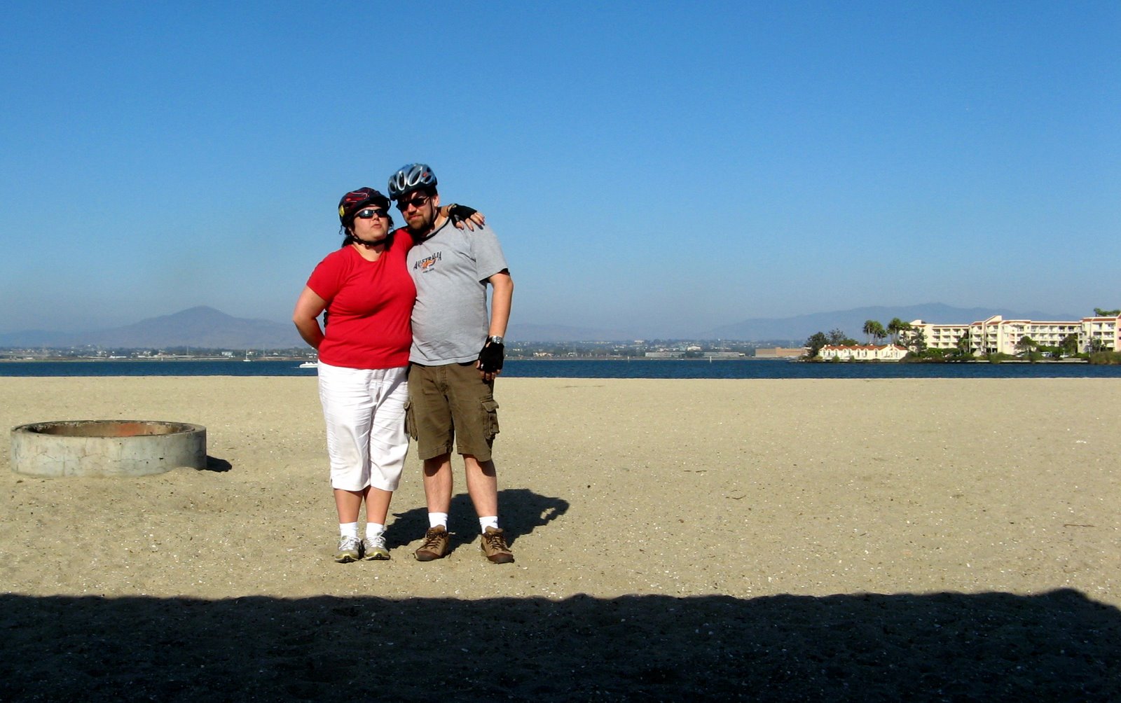
For Christina's birthday, we drove the bikes down to Coronado and rode down to Silver Strand State Beach. When I looked at the satellite view of the trip, I realized that the ride had covered about half the distance from Coronado to Mexico (hence the title of the post).

The ride is really beautiful, with San Diego Bay on one side and the Pacific Ocean on the other. The beach is also very nice -- it's actually two beaches, one on each side.

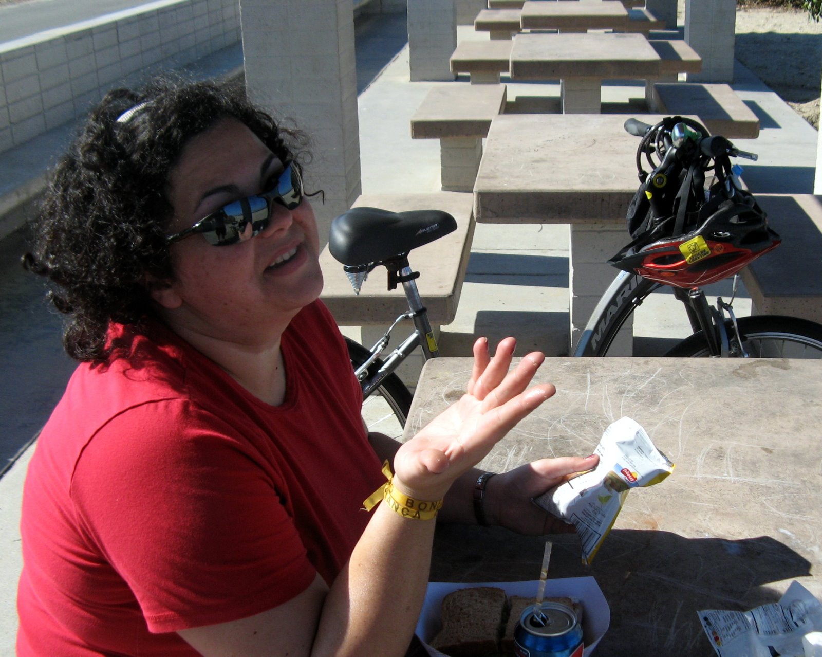
All in all, a fun excursion, and a fitting way to celebrate Christina's birthday, since she got us on the biking kick starting with our trip to Holland almost a year ago.


Posted by Picasa