Thursday, January 21, 2010

My radio appearance


Here's the audio file from my appearance today on the Colin McEnroe Show. (You can go to the public radio website to hear the whole show.)

Radio Days


What do I have in common with two Connecticut TV weathermen? The three of us will be guests on Connecticut Public Radio's The Colin McEnroe Show today -- me in my capacity as Dr. Snowpanic. The producer told me that my segment will appear around 1:40 PM EST.

Tuesday, January 19, 2010

How I Became Mayor of Noodles & Company

I like playing with new web concepts when I come across them. Sometimes they take off -- Blogger, Facebook. Sometimes they don't -- Movielens and Wikitravel Extra are two that come to mind.

I read an article about Foursquare and decided to give it a try. It's sort of...I don't know, a cross between Facebook and Waymarking? When you travel to actual locations (for example, bars and restaurants), you use your smartphone to "check in", and Foursquare will tell you which of your friends are nearby. Furthermore, you earn "points" for checking in, and you earn "badges" for certain types of check-ins. Also, if you're the person who checks in the most at a particular location, you are declared "mayor" of that location.

Fortunately, this impulse to try Foursquare coincided with our kitchen renovation, so I have lots of reasons to go out to get food and "check in".

So what are my impressions?

  • Advantage 1: It's social networking that involves getting off your butt and in front of the computer. Instead of sitting at home and posting Facebook updates, Foursquare actually encourages you to get out of the house and do things.
  • Disadvantage 1: Advantage 1 is completely negated, if, like me, none of your friends are on Foursquare.
  • Disadvantage 2: Even if they were, none of us are in the "Hey, let's head out on the town and see who we run into" phase of our lives. I could see this being pretty neat 15 years ago in grad school. But then again, none of us would probably have been able to afford smartphones.
  • Advantage 2: It's a game, but one that rewards you for getting out of the house. If I'm willing to sit at home and click away to earn virtual achievements in Farmville and Mafia Wars, why wouldn't I be willing to "check in" four days in a row to earn the "Bender" badge? (How far I fall from the target demographic is summarized by the message: "Bender That's 4+ nights in a row for you! Unlocked by Jon G. on Sun Jan 17, 2010 at 10:54 AM @ Bagel Place - College Park in College Park.")
  • Disadvantage 3: It's not a particularly well-developed game. As far as I tell, you can achieve three things in the game. First, you can get the aforementioned badges (apparently, there are some more specialized ones, such as "gym rat" for visiting gyms a lot). Second, you can become mayor. (The only place I've "checked in" more than once is Noodles & Co., hence my possession of the mayoralty there.) Finally, you get "points" every week. There's a leaderboard, which I seem only to access from the mobile web site. I am #1 among my friends (since nobody else uses foursquare), and not in the top #100 in the DC metro area. Yay?
  • Disadvantage 4: It's pretty easy to cheat. While I appreciate the fact that I can check in via the web from my 2007 vintage, non-location-aware smartphone, foursquare should probably eventually move towards something better locked down. Why would someone want to cheat at foursquare? I don't know, but sadly, every pointless web-based game I've ever seen has drawn some people who want to cheat for whatever reason.


In conclusion, the game is sort of interesting, but they probably need to spruce it up a little bit if it's going to have any staying power. The interaction of the virtual world and the real world is promising, but I'm not sure if they're poised to take advantage of it. Maybe someone else will do a better job and create something that's a better fit.

I'll probably keep "playing" at least until I earn the superuser badge -- that's 30 checkins in one month. At that point, I'll be able to point out duplicate listings -- it's kind of driving me crazy that one neighborhood restaurant appears four times. I'm not sure that's enough incentive to keep me sticking with it a month from now.

Tuesday, December 29, 2009

World Heritage: 2009 in Review


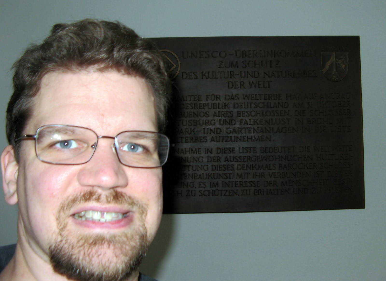
Well, this year I made it to two World Heritage sites, the lowest total since 2001. I sort of saw that coming, given the location of this year's conferences. Still, I was happy to make it to these two sites:

  1. Augustusburg Castle in May
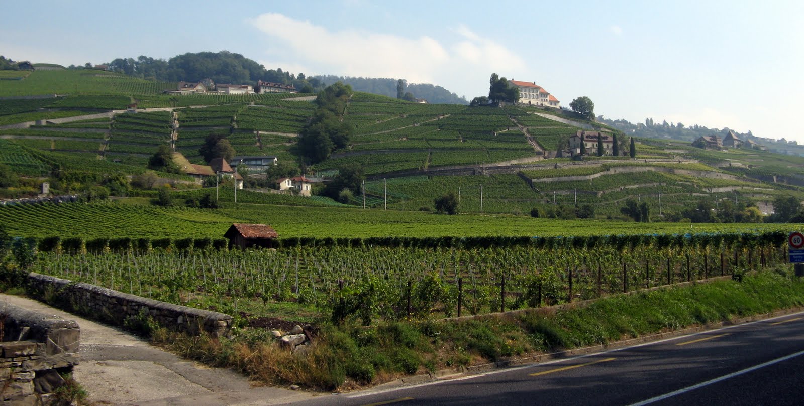
  2. The Lavaux Vineyards in September


The list is up to 890. I didn't pick up any from new inscriptions again this year. My 46 out of 890 gives me 5.2%, marginally up over last year's 5.0%. I don't anticipate a big haul next year, but one conference near an iconic World Heritage Site (on the level of Stonehenge) intrigues me. Stay tuned...

Friday, December 25, 2009

FIFA 10

I've been playing with my new FIFA 10 game for the PS3. I'm not very good at it, but you wouldn't know by this goal I scored on a free kick.

Friday, December 18, 2009

snowpanic.com

In an attempt to monetize the coming snowpocalypse, I've created snowpanic.com, where I'm tracking the impending doom coming our way.

Monday, November 16, 2009

Pillars of the Earth at Euro Quest 2009


Euro Quest 2009
Originally uploaded by Eric E Haas
Christina, Martin, Ben and I played "Pillars of the Earth" Saturday afternoon at the EuroQuest gaming convention. Two nice gentlemen had taught Christina and me to play it on Friday, and then we played again on Saturday with friends. It was a pretty fun game, though I had never read the novel on which it was based.

Sunday, November 15, 2009

Race for the Galaxy at Euro Quest 2009


Euro Quest 2009
Originally uploaded by Eric E Haas
Martin, Ben and I kicked off yesterday morning at EuroQuest with a couple of games of Race for the Galaxy. It was fun switching to casual gaming after more than a day of tournaments.

Friday, November 13, 2009

Playing Dominion at Euro Quest 2009


Euro Quest 2009
Originally uploaded by Eric E Haas
I came in a close second. Then, this morning, I came in a close third. (I would have won if I had one more turn.) I'll need to win in the third heat to have a chance of advancing.

Thursday, October 22, 2009

New Sign at Trolley Trail/Paint Branch Crossing


This morning I noticed some new signs at the long-problematic crosswalk where the Paint Branch Parkway meets the College Park Trolley Trail. Despite the button-activated flashing lights, there have been a number of accidents at the crosswalk. Various solutions -- a stoplight, speed cameras -- have been proposed, but instead we get this sign (and another one on the other side attached to the flashing lights).

Three things occur to me about these signs.

  1. The advice is probably sound.
  2. That's not how a crosswalk is supposed to work.
  3. They provide a way of blaming the next pedestrian or cyclist who is hit by a car. "Clearly, he didn't wait for the vehicle to stop, or he wouldn't have been hit."

Saturday, September 12, 2009

Halfway to France (and Back)

Last month, I told you about biking halfway to Mexico. Yesterday, I had the pleasure of biking halfway to France. I borrowed a bike from Lausanne's free bike rental program and headed along the lake to Vevey, about 10-12 miles away. It looks like if I had continued around the circumference of the lake, another 10-12 miles would have put me in France. I suppose biking all the way around the lake would make a good vacation, but since all I had was a free day after four days of conferences, this trip was a nice diversion.


For a more detailed analysis of my route, you can check out my Everytrail post. Here's what I had to say about the ride there:
I should have taken the Metro to the Ouchy station near the lakefront, but I let the guy talk me into riding my bike. Of course, I couldn't understand his directions in broken English and ended up riding all over the place before getting out of town.

Once I got out of town, however, the ride was great. There is a main road near the lake, which has bike lanes most of the way, but occasionally there were detours. At one point, I rode through a medieval town center, and at another point, the route rose through the terraced vineyards that hug the coast. I could have reached out and grabbed the grapes. (I didn't.)

When I got to Vevey, I visited the tourist information center, ditched the bike, and headed out. The woman in the information center claimed that there was nowhere to lock my bike, but that I didn't need to. She also sent me to a mall when I asked about souvenirs, so I'm not sure of the quality of her advice. I locked the bike to a sign, which seemed to work. I had lunch at a Thai restaurant, bought some postcards and visited Charlie Chaplin's grave. All in all, a successful visit.

On the ride back, I tried to minimize my detours, not entirely successfully. I had an idea of leaving my bike at Ouchy, then returning for it via Metro after rush hour was over. I really wish I had done that; I meandered all over town trying to find a good route back to Roule Lausanne. Eventually, I did and left tired after my longest bike ride yet.


I should note that both the tourist information center and Chaplin's graves are waymarks, which allowed me to find them more easily. I now have the "grave of a famous person" category. While that doesn't help me with waymarking bingo, it does bring me up to 251 waymarks.

Also, the Lavaux vineyard terraces are a World Heritage Site, which makes them the 46th that I have visited, and the 2nd for 2009.

Finally, here is a link to a Picasa album I made up with some selected pictures from my trip. Now it's off to change my remaining Swiss Francs into British Pounds and find the gate for my plane...

Switzerland

Wednesday, September 09, 2009

In Search of the Northwest Passage


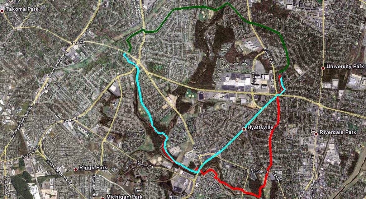
I've been trying to find a good bike shortcut to Takoma Park and Silver Spring. Driving, we have a more-or-less straight shot up East-West Highway, but that isn't suitable for driving. And once I get close, the Sligo Creek Trail and various on-road bike routes make things easy. But it's tricky handling the distance between home and where the East-West Highway hits Sligo Creek Trail.

Fortunately, I collect lots of data about my rides, so I can make both an objective and a subjective comparison.

My first attempts (red path) were done by going south through Hyattsville and Magruder Park and taking the Northwest Branch Trail to the Sligo Creek Trail. It's somewhat roundabout, but it's all easy biking on either residential streets or a scenic set of trails. Time: 31 minutes. Distance: 4.6 miles.

From the first time I looked at the map, I had my eye on a route via residential streets to the west of home (green path). Christina and I explored the route via Wells Parkway and Wells Boulevard to a park we call "Stolen Mulch Park". (The first time we drove by, we saw some women helping themselves to some mulch that had been clearly placed for park use.) One day I decided to push through along the route marked on my bike map. Unfortunately, this route involves crossing Riggs Road, but not at a crosswalk. Riggs Road is fairly busy and doesn't feature many lights or crosswalks. It does have a median, so I did eventually get across, but it was not fun. The only thing this route has to recommend it is that it is the shortest-distance one I tried. Time: 25 minutes. Distance: 2.9 miles.

When I looked at the map again, I saw Queens Chapel Road marked as a bike route (blue path). I had been fairly skeptical, because I know Queens Chapel is fairly busy outside of University Park. When I rode down it, however, I realized it has a nice, wide shoulder. Except for a small segment where people park cars on weekends, it's fairly easy to avoid most traffic before picking up the Northwest Branch Trail. It's a bit hillier than other routes, and not as scenic as going via Magruder Park, but it's the fastest route, and it doesn't involve any scary intersections. If I'm trying to make it farther into Montgomery County, I'll definitely take this path; if I'm looking for a more leisurely ride, I'll probably go via Magruder Park. Time: 22 minutes. Distance: 3.6 miles.

This analysis may seem like overkill for differences of at most 9 minutes or 1.7 miles. But those differences are doubled for a round trip and definitely make a difference between a reasonable ride and one that leaves me feeling wiped out. So, until the county wises up and builds a better path, I think I have the information I need.

Posted by Picasa

Tuesday, September 08, 2009

Google Books, genealogy and the Metcalfs

I was reading an article about Google scanning books and putting them on-line, and I decided to see if I could use some of these books to help me with genealogy research. I found out that one of the books scanned was "Metcalf Genealogy", published in 1898. As it turns out, my great-great-great aunt married a Metcalf...

This snippet was of some interest:

Ann Elisabeth Howes, born March 31, 1847; lived,
after her parents' death, with Clark Eldred, Elyria;
taught school many years in Lorain County, O., and Grant
Co., Wis.; married, October, 1879, to Alexander Cairns,
of Bloomington and Mt. Hope, Wis. One son, Earl
Cairns, born Aug. 9, 1880.


(Earl Cairns was my great-grandfather.)

My great-great grandmother Ann Elizabeth Howes was born in Northampton, England. Her parents, William and Elizabeth Howes, came to Ohio from England some time between 1850 (when their 5th child was born) and 1852 (when their 6th child was born). Not long after that, they got sick and died. Their children were adopted out to six different families in Elyria, Ohio. Ann's two oldest brothers fought in the Civil War; both died, although one of them, a doctor, survived with his wounds until 1874. Two other siblings married their adoptive siblings (ewww). (The remaining sister was the one who married a Metcalf.)

Of Ann's parents, the book says this:

William Elliot Howes, born March 22, 1818; married
Elisabeth West, who was born Sept. 27, 1817, at Gaton-
wood House, Northampton, Eng., where the family had
lived for three hundred years. Elisabeth West's father,
Thomas West, was born March 23, 1785; died Jan. 3,
1828. His wife, Ann Fairbrother West, was born June
18, 1785. After her husband's death she managed the
great Gatonwood Farm herself for nearly forty years, dy-
ing Jan. 29, 1866.
Gaytonwood Farm appears to be a campground now; here is a picture.

This book contains a lot more information about this branch of the family than had before. I have now added a lot of information about Ann Elizabeth Howes and her family to my database. Learning from past mistakes, I have footnoted it carefully with the source. Google Books gets a thumbs-up for its treatment of out-of-copyright books. (I am taking no position on their handling of in-copyright works.)

Wednesday, September 02, 2009

Grantham's Problem

(Cross-posted from my math blog, which I'm pretty sure nobody reads.)

While reviewing the referee's 44 (sigh) suggested changes to my paper, I came across an article published last November entitled "Inefficacious Conditions of the Frobenius Primality Test and Grantham's Problem".

I have a problem named after me!

So the next time someone asks me, "What's your problem?" I can say, "Are there any composite numbers n ≡ ±2 (mod 5) such that x^(n+1) ≡ 5 (mod(n, x^2 + 5x + 5))?"

Sunday, August 30, 2009

Biking Santa Barbara


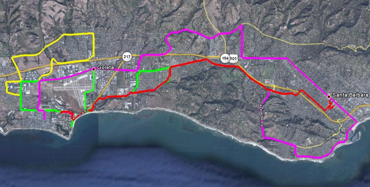
I rented a bike when I was in Santa Barbara for a conference earlier this month. I got in over 80 miles of biking in 4 days, so it was more than I'm used to doing. One day I did 27.9 miles, a personal best (and an exhausting one). The weather was cool, the terrain was flat, and the bike paths were well marked -- all conducive to lots of riding. Two of the days I just rode around near campus on breaks from the conference. Two of the days, on the other hand, I had free afternoons and challenged myself to ride from campus to downtown Santa Barbara.

Both times I did some waymarking...I made it up to 250 categories (from 202 in February). I thought the bike would be great for waymarking, but there were so many waymarks close together, the bike was a nuisance. (Or the waymarks were.)


Posted by Picasa

Tuesday, August 04, 2009

Halfway to Mexico (and Back)

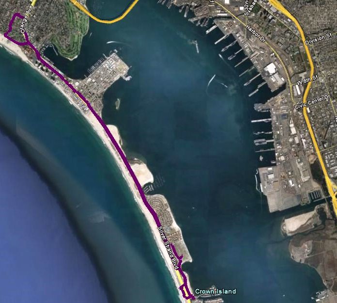
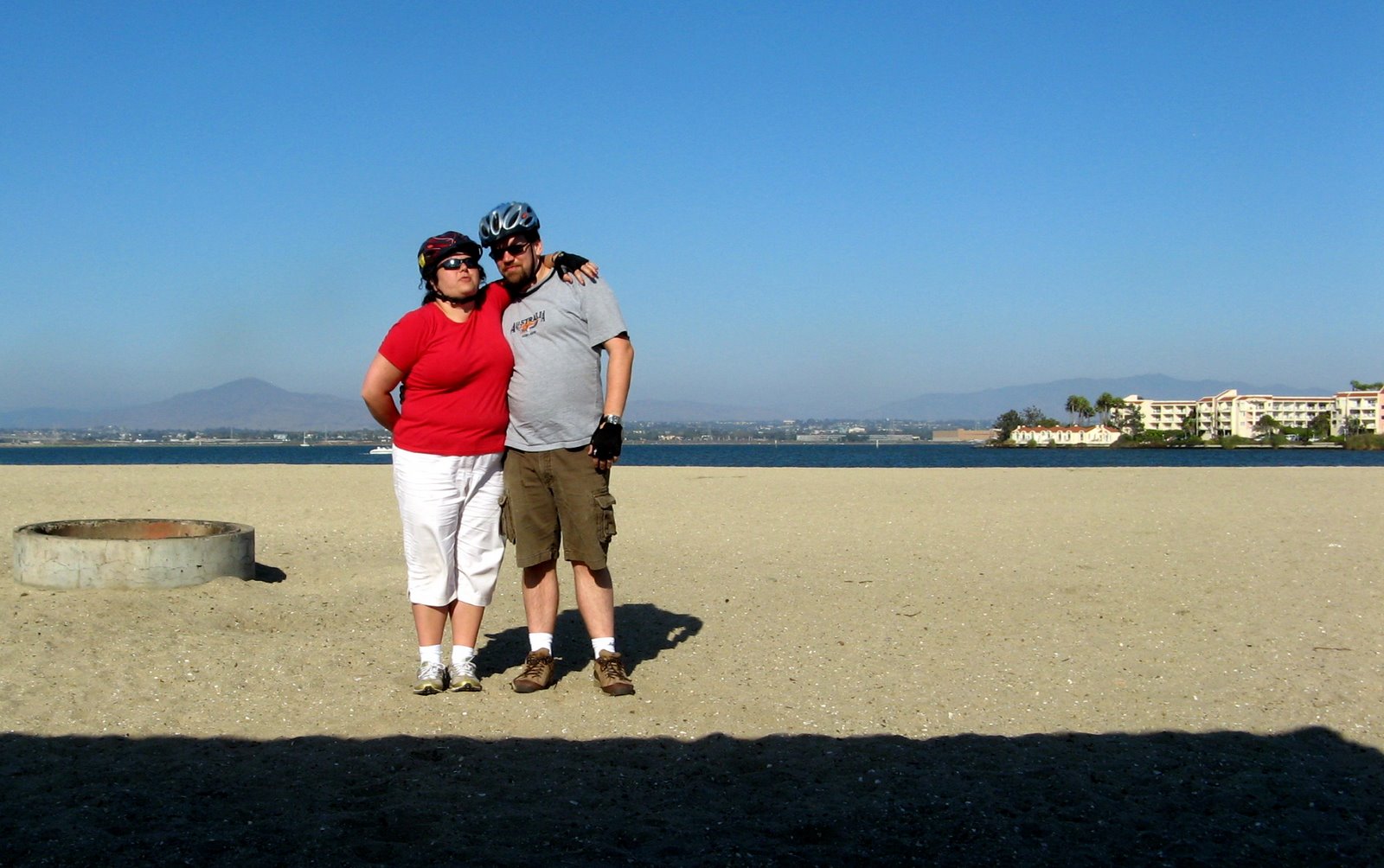
For Christina's birthday, we drove the bikes down to Coronado and rode down to Silver Strand State Beach. When I looked at the satellite view of the trip, I realized that the ride had covered about half the distance from Coronado to Mexico (hence the title of the post).

The ride is really beautiful, with San Diego Bay on one side and the Pacific Ocean on the other. The beach is also very nice -- it's actually two beaches, one on each side.

All in all, a fun excursion, and a fitting way to celebrate Christina's birthday, since she got us on the biking kick starting with our trip to Holland almost a year ago.


Posted by Picasa

Thursday, July 23, 2009

Bike To Work

 
Posted by Picasa


On Monday, we drove down to Coronado and rented bikes. On Tuesday, I biked to work, following the above path. It's a lot easier in California, what with the bike lanes and such. I also biked to work on substantially the same path the following two days -- I'm not going to record any more trips to work unless I take a different way. I have one idea for that, but the path depicted above has been easy enough -- about 3.5 miles each way, no incredibly awful stretches of uphill biking.

Saturday, July 18, 2009

3 recent bike trips

I've had three more bike rides in the past week.


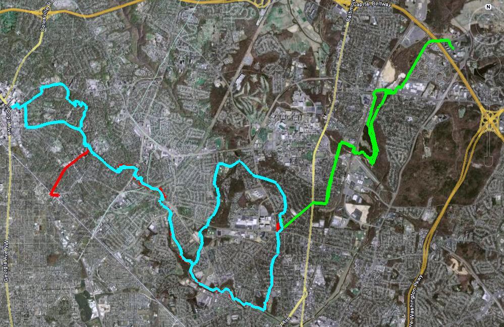
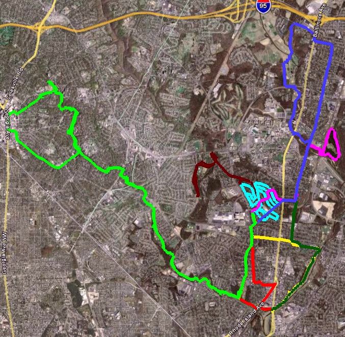
Last weekend, I took another trip to Silver Spring (light blue path). On the way there, I tried a partial shortcut. While the full shortcut will undoubtedly save 1.5-2 miles, the partial shortcut was longer. On the way back, I went the "long" way and didn't get lost, and it was only 8.4 miles. The full shortcut should bring this under 7.

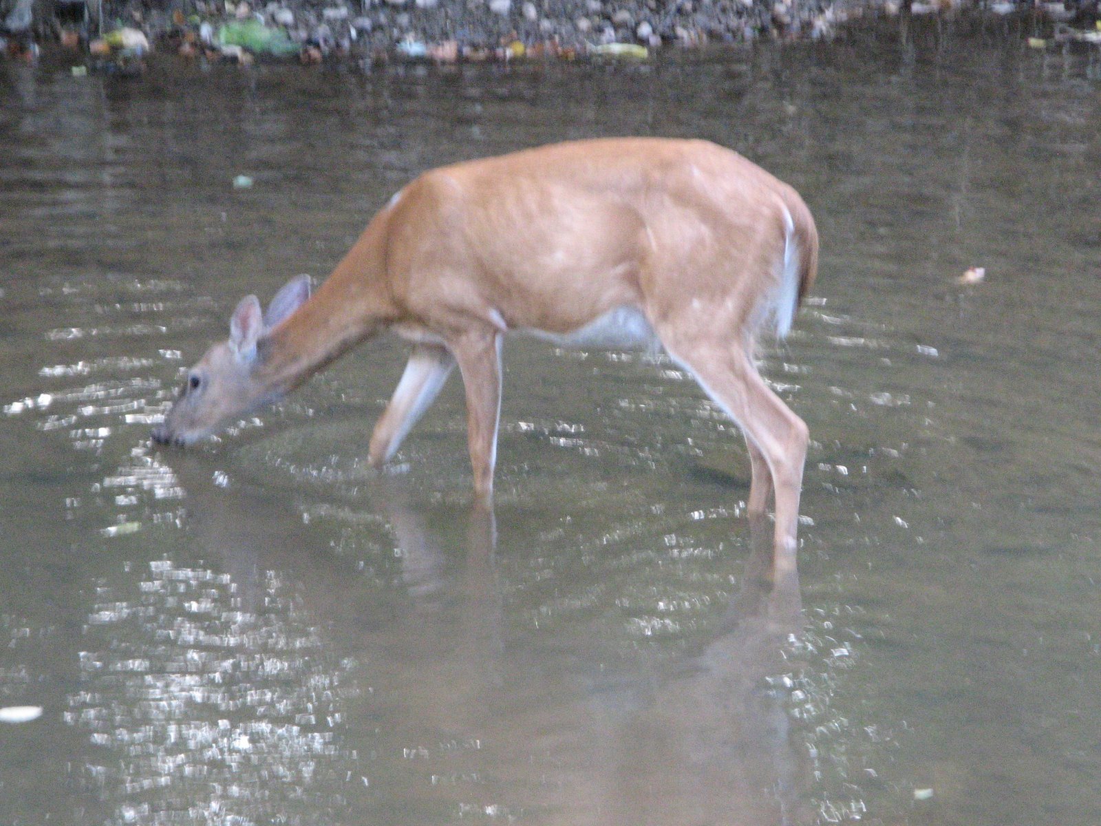
On Thursday, I was testing out the start of a path to work, and I ended up making it as far as the Greenbelt Marriott (green path). The on-road biking was a little bit dicey. I think next time I can go via Rhode Island Avenue and have a calmer experience. On the way, there, I saw a deer cross the Indian Creek Trail and head into the Indian Creek.


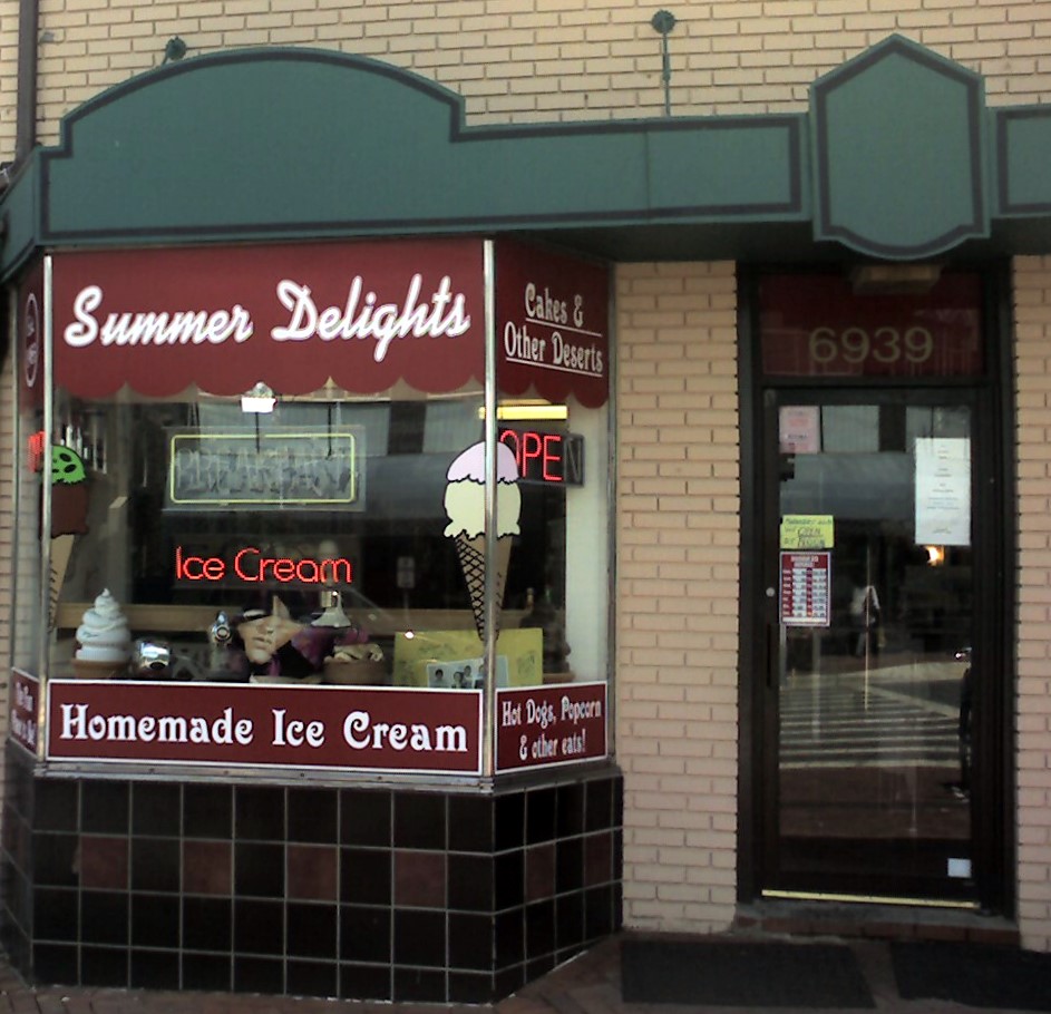
Today I decided to head to Takoma Park (red path, mostly overlapping with the light blue path). That ended up being 7.6 miles, not incredibly shorter than the Silver Spring trip. I enjoyed some ice cream and then headed back.

Saturday, July 11, 2009

Early July Biking


I like the above map as a way of summarizing a bunch of bike rides at once. I've continued logging my trips at Everytrail; links below.

Wednesday, July 01, 2009

This week's biking

I've been happy enough posting my bike trips on Everytrail, so I've stopped putting them here. Instead, I'm going to post weekly summaries and pointers. (The embedding last time didn't work too great.)
 
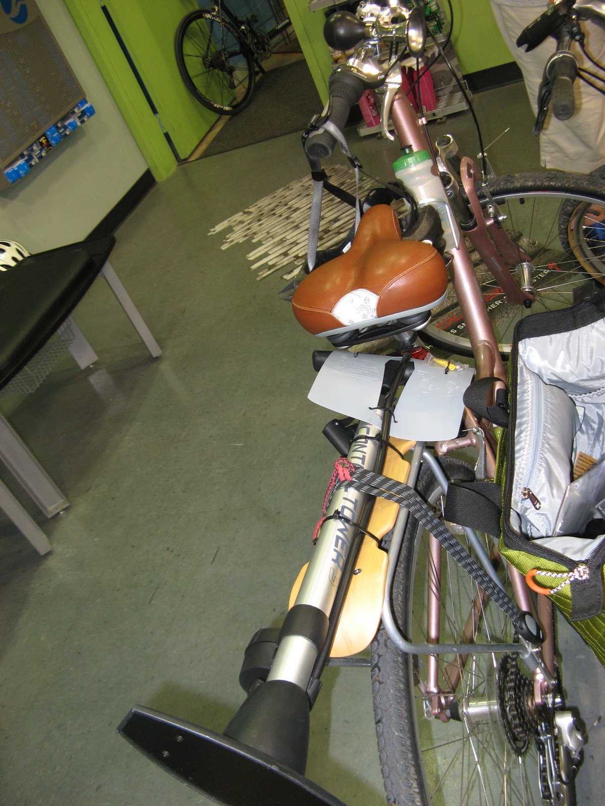
Last Wednesday, we went to Arrow Bicycle to get a replacement inner tube, a full sized bike pump and other accessories. The picture is of the bike pump strapped to Christina's bike rack, since that was the only good way to transport it home.
Thursday morning, I had a quick ride out to Lake Artemesia.
 
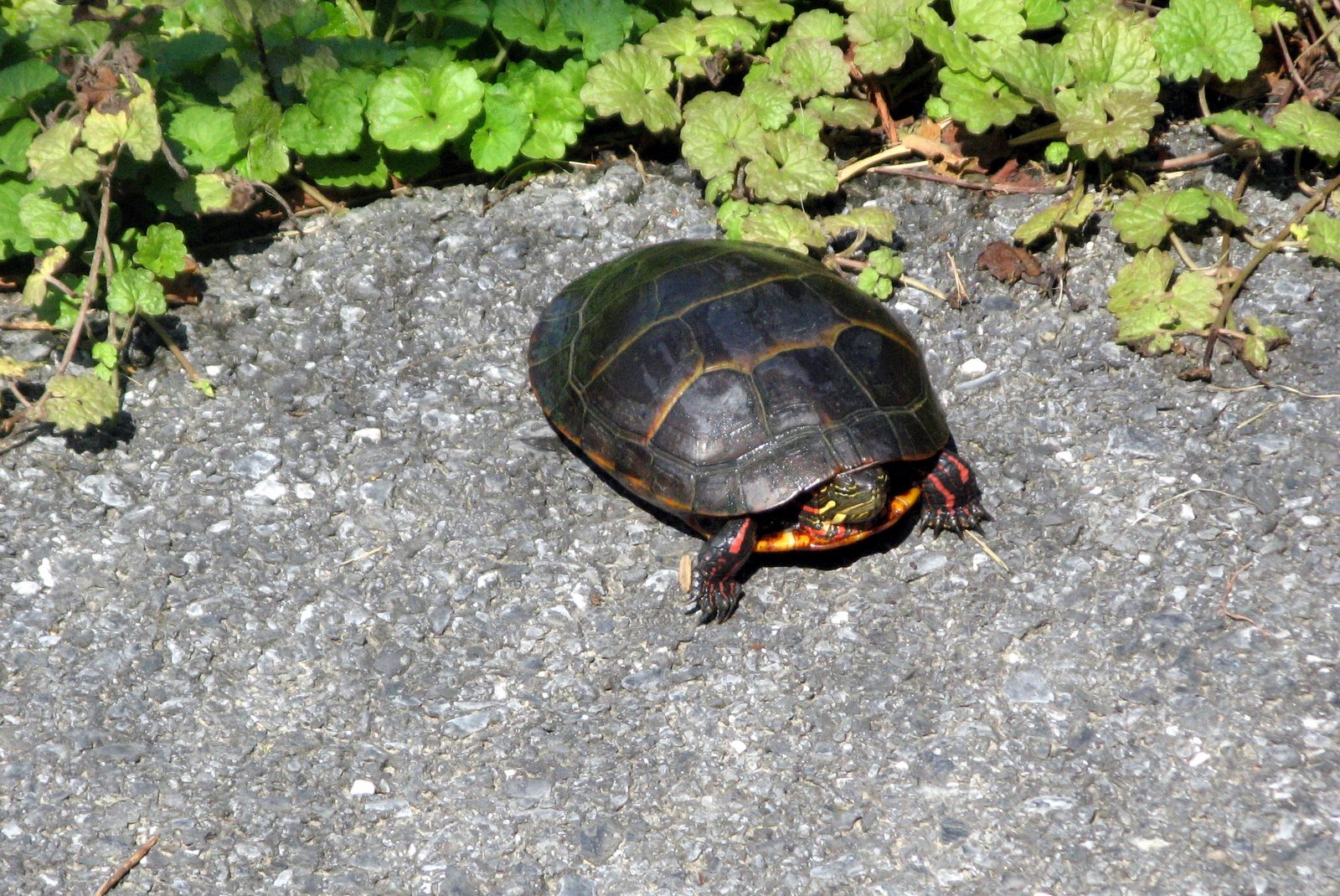
Saturday morning, I rode to the end of the Paint Branch Trail (and saw a turtle).
 
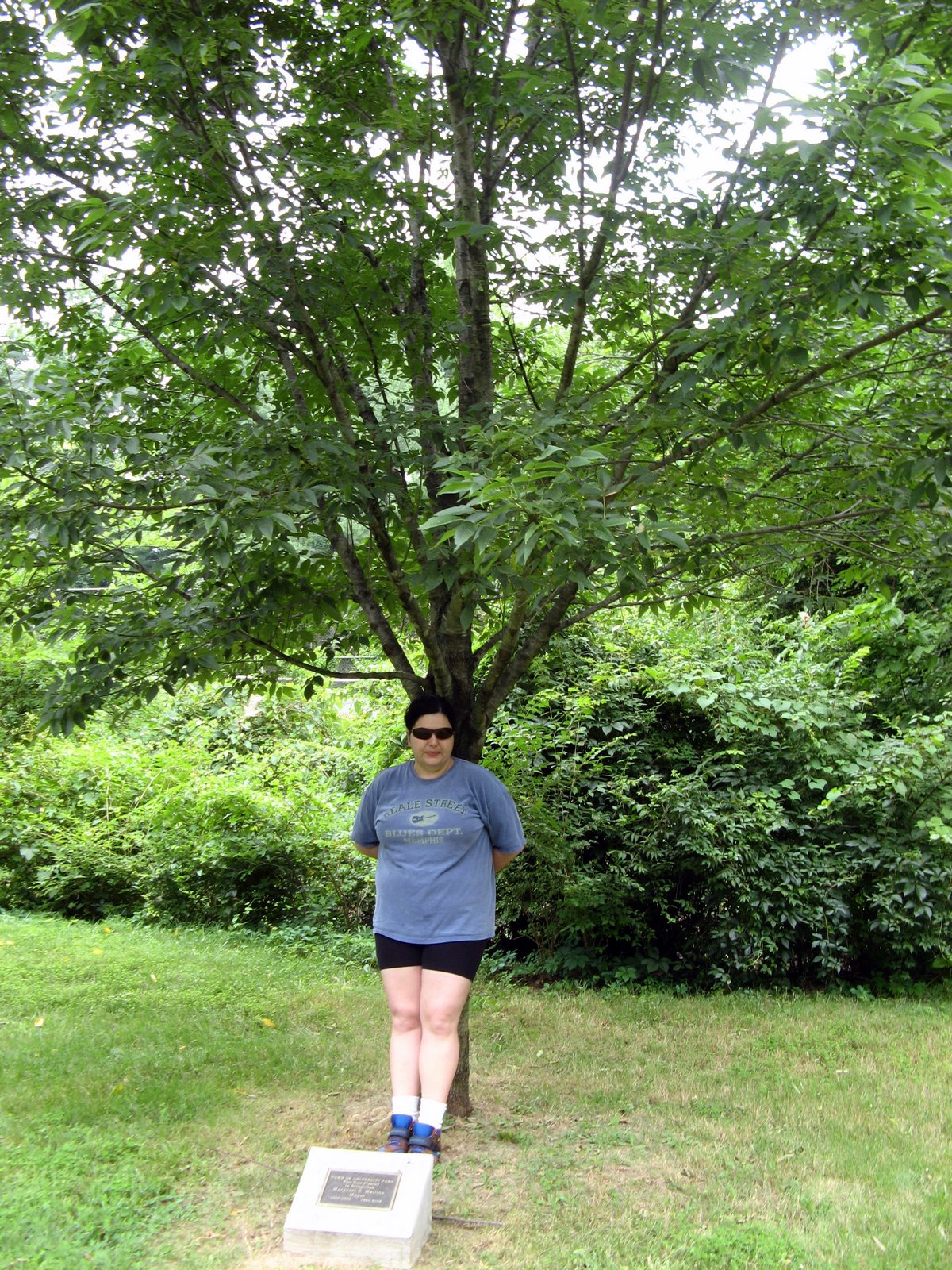
Sunday, we saw a tree dedicated to our former mayor, and looked at some nice houses in town.
 
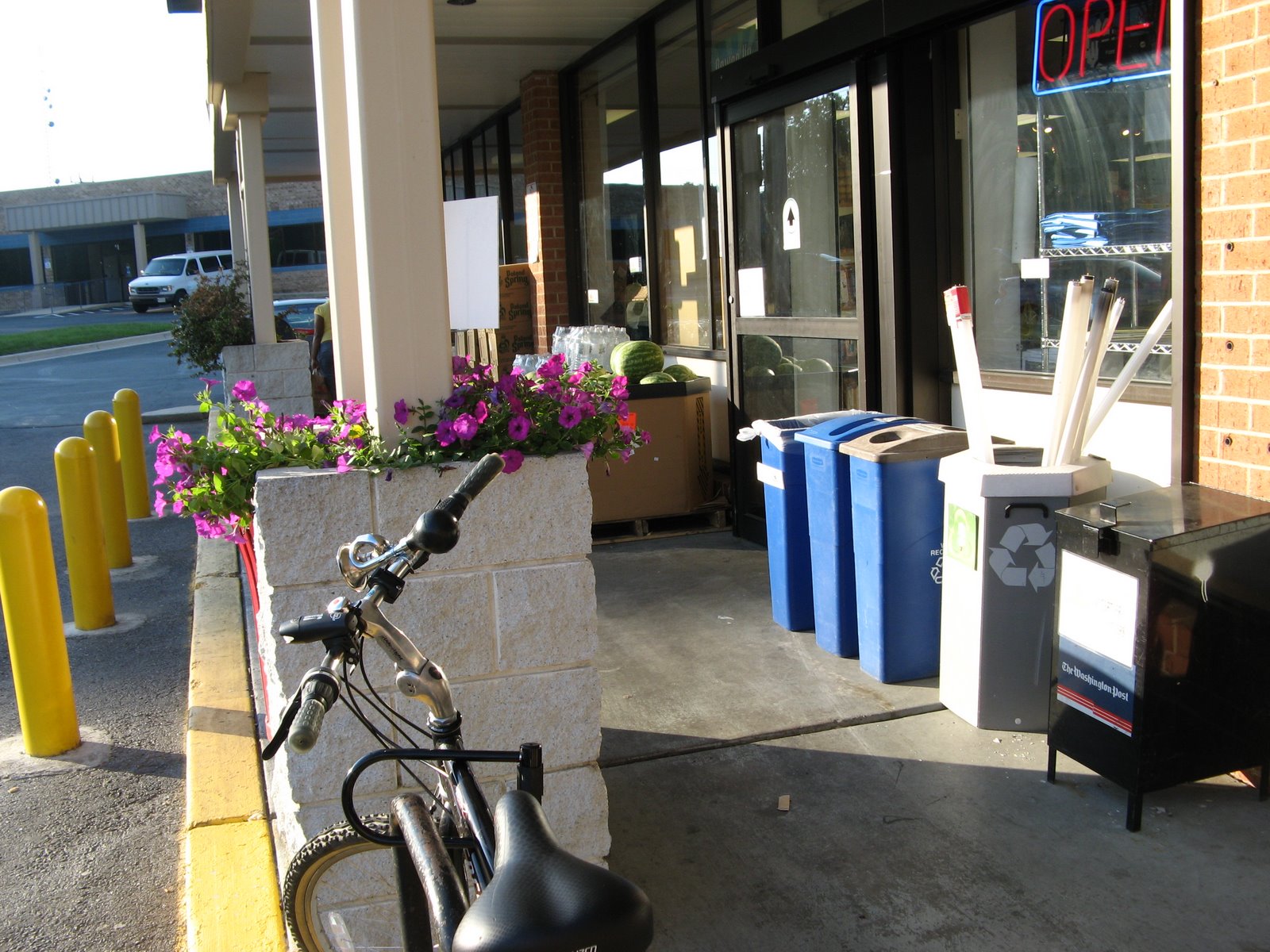
Monday, I rode out to the store and brought back some food (useful biking!). Tuesday, I explored the Indian Creek Trail and other new routes.
Posted by Picasa